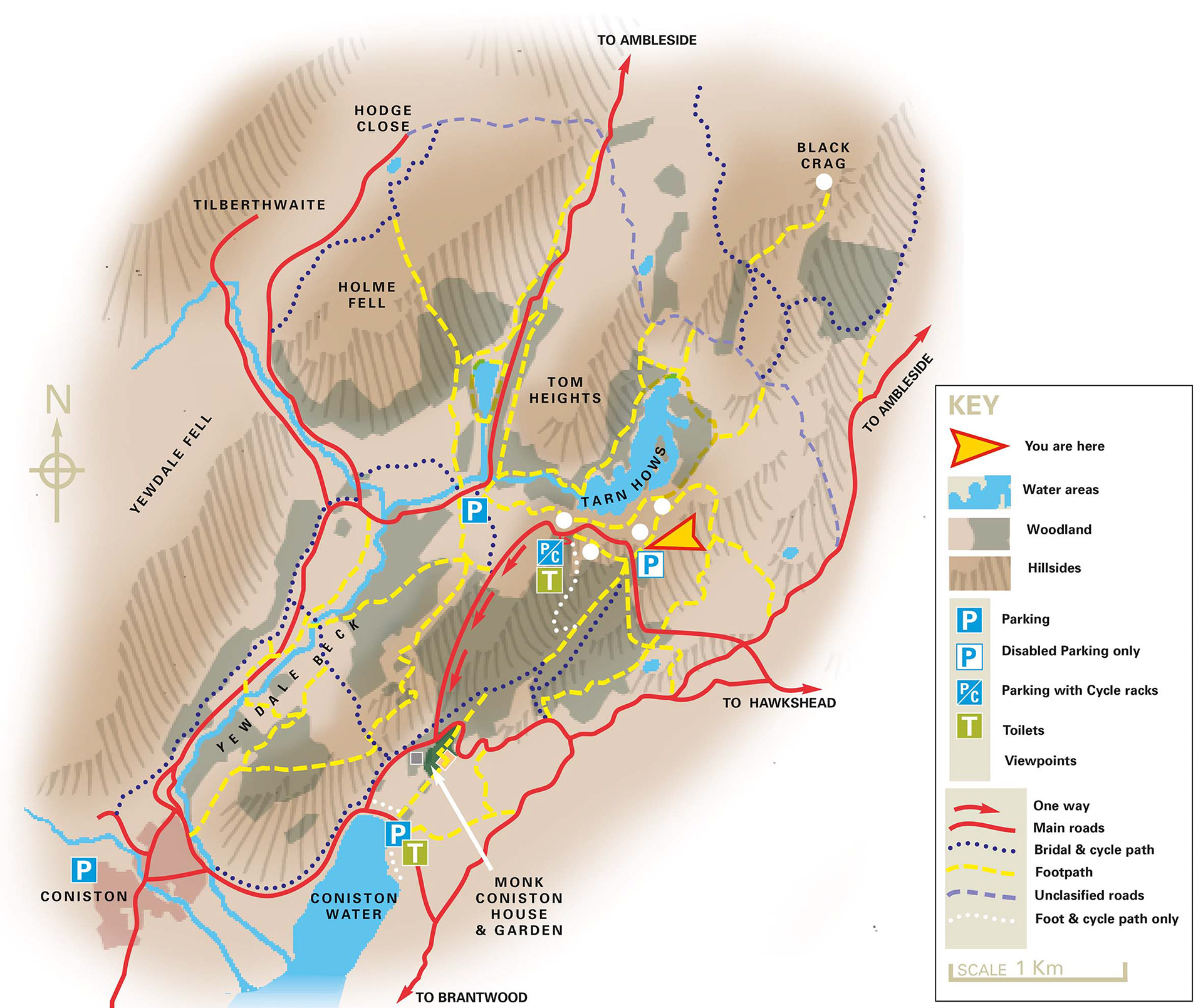
Lake District trail map for the Monk Coniston estate, Cumbria, showing walks and tracks to aid visitor orientation.
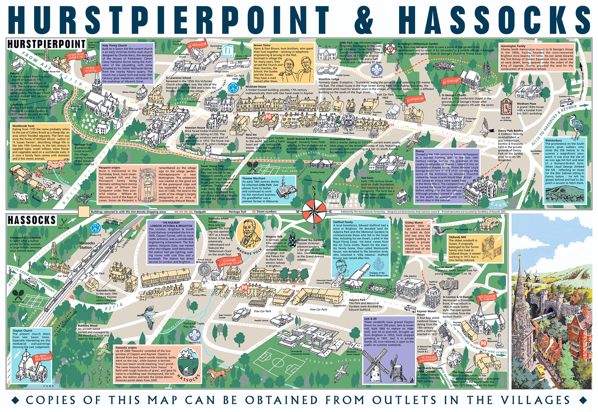
A car park map for two villages in Sussex. Showing buildings and features of note along with box text information. (folds to 1/3 A4).
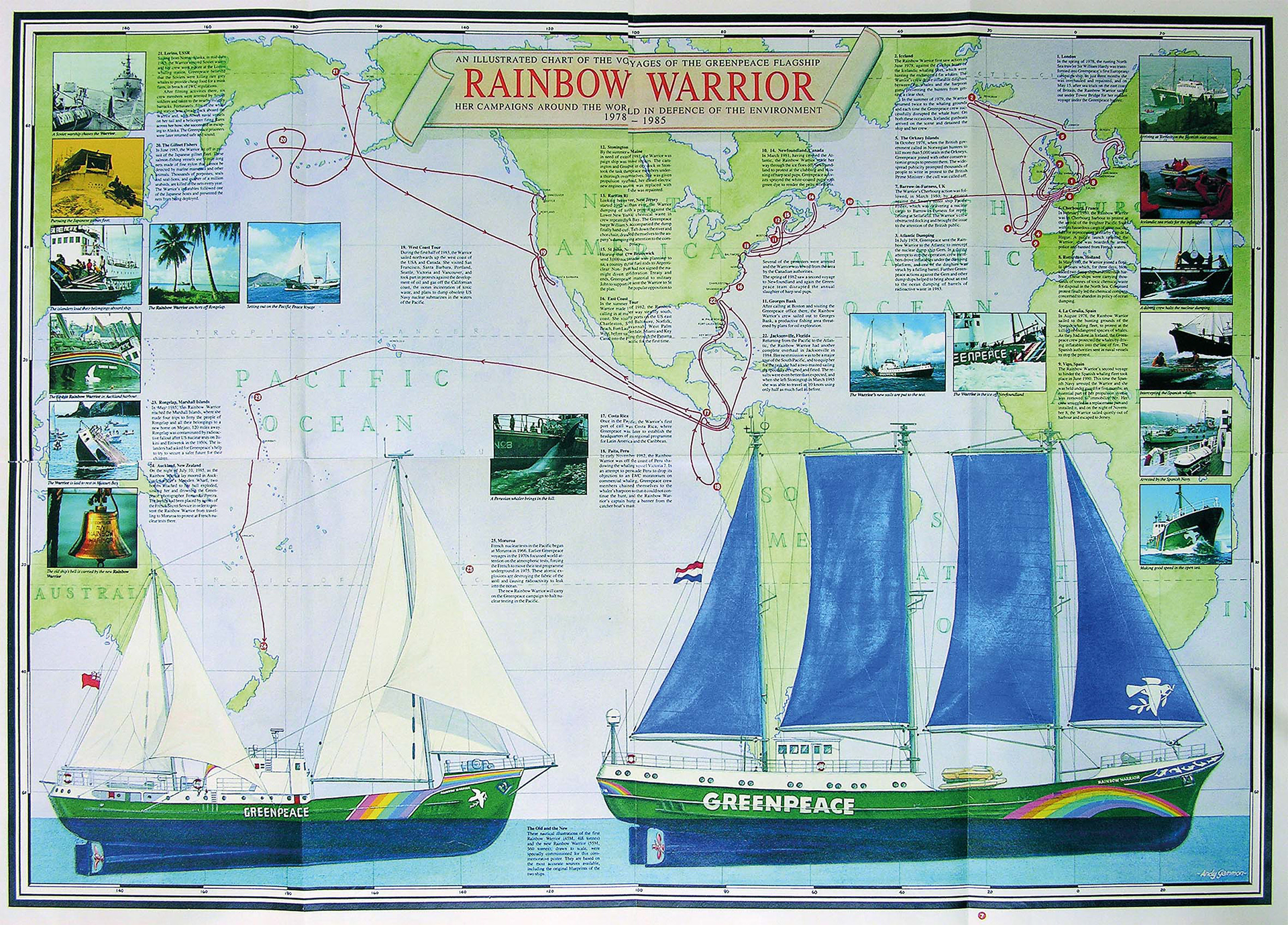
One side of an A1 poster magazine commissioned by Greenpeace to celebrate the voyages of the first Rainbow Warrior vessel and to announce its replacement, after the bombing of the first ship in Aukland harbour by the French secret service. (folds to A4)
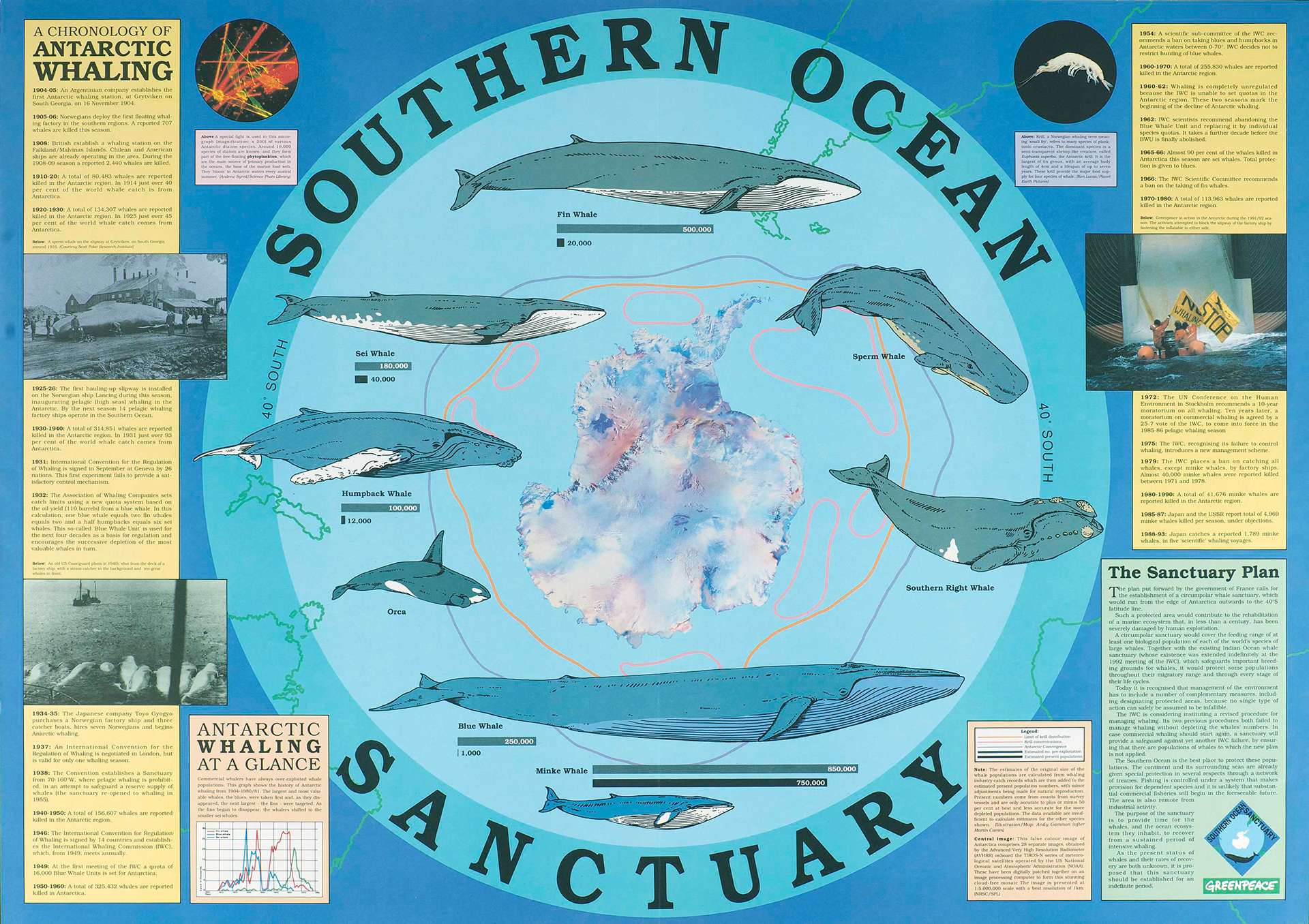
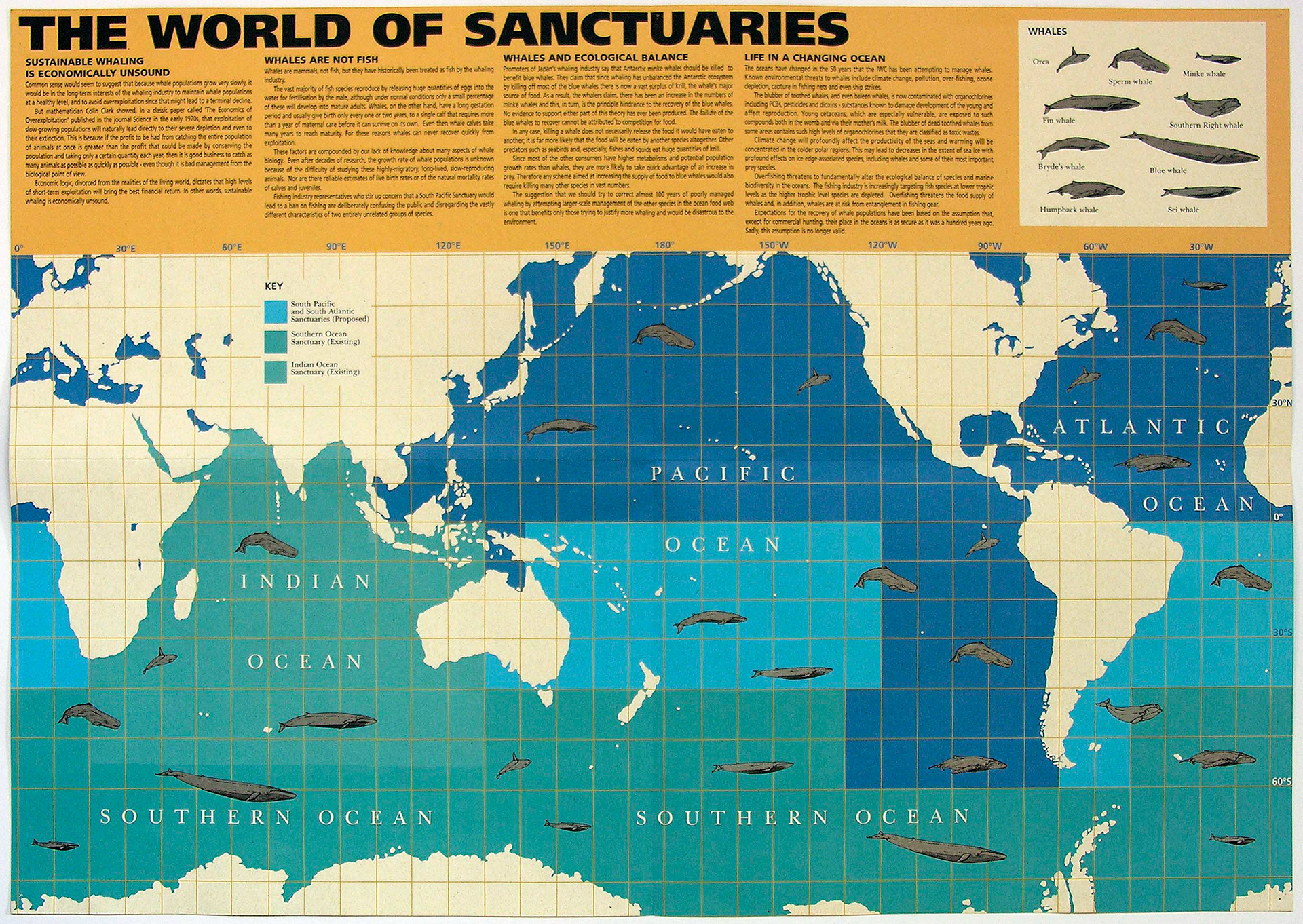
Two Greenpeace Whale Campaign poster magazines - folds to A4
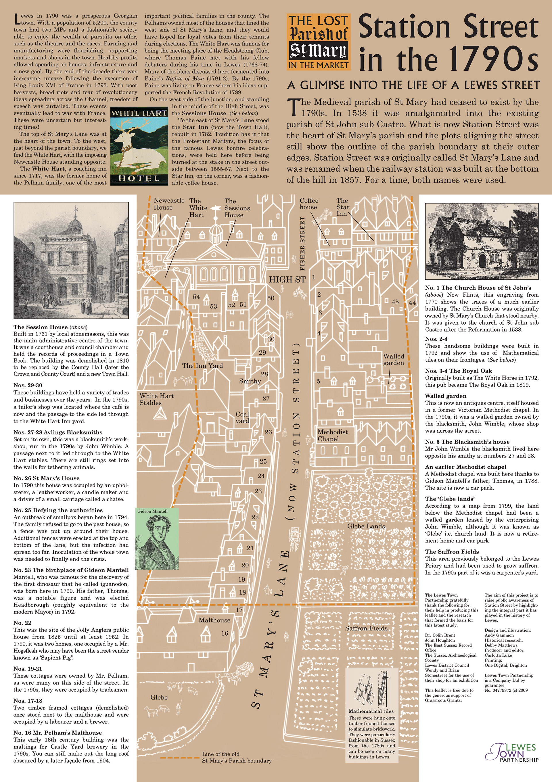
St Mary in the Market Parish and St Mary's Lane (now Station Street), Lewes. Showing the parish boundary and the buildings that were there in 1790. Used as a wall panel for visitor information in the street as well as a folded A5 brochure.
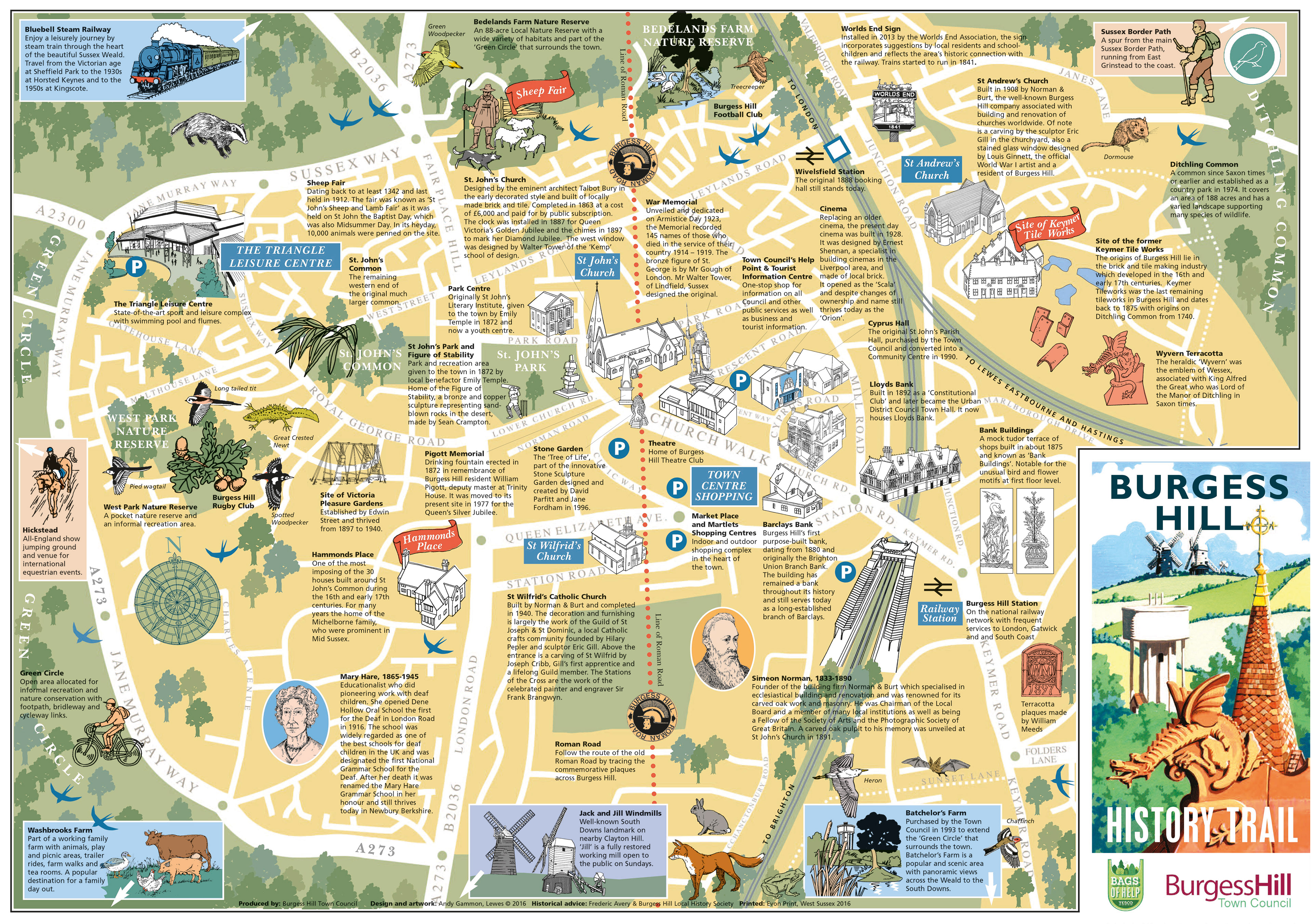
Burgess Hill Town Map (folds to 1/3 A4)
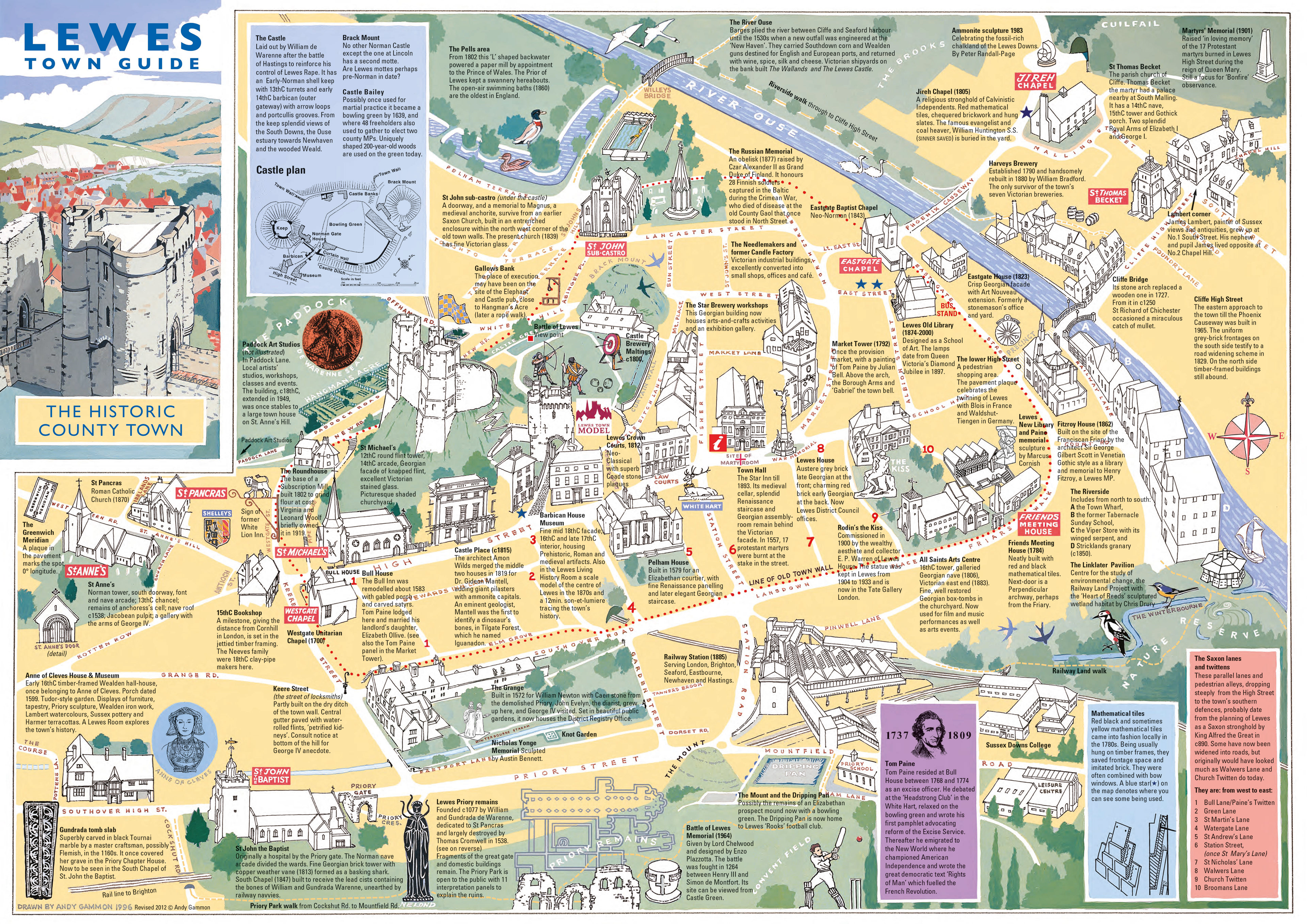
Lewes Town Map, (folds to 1/3 A4)
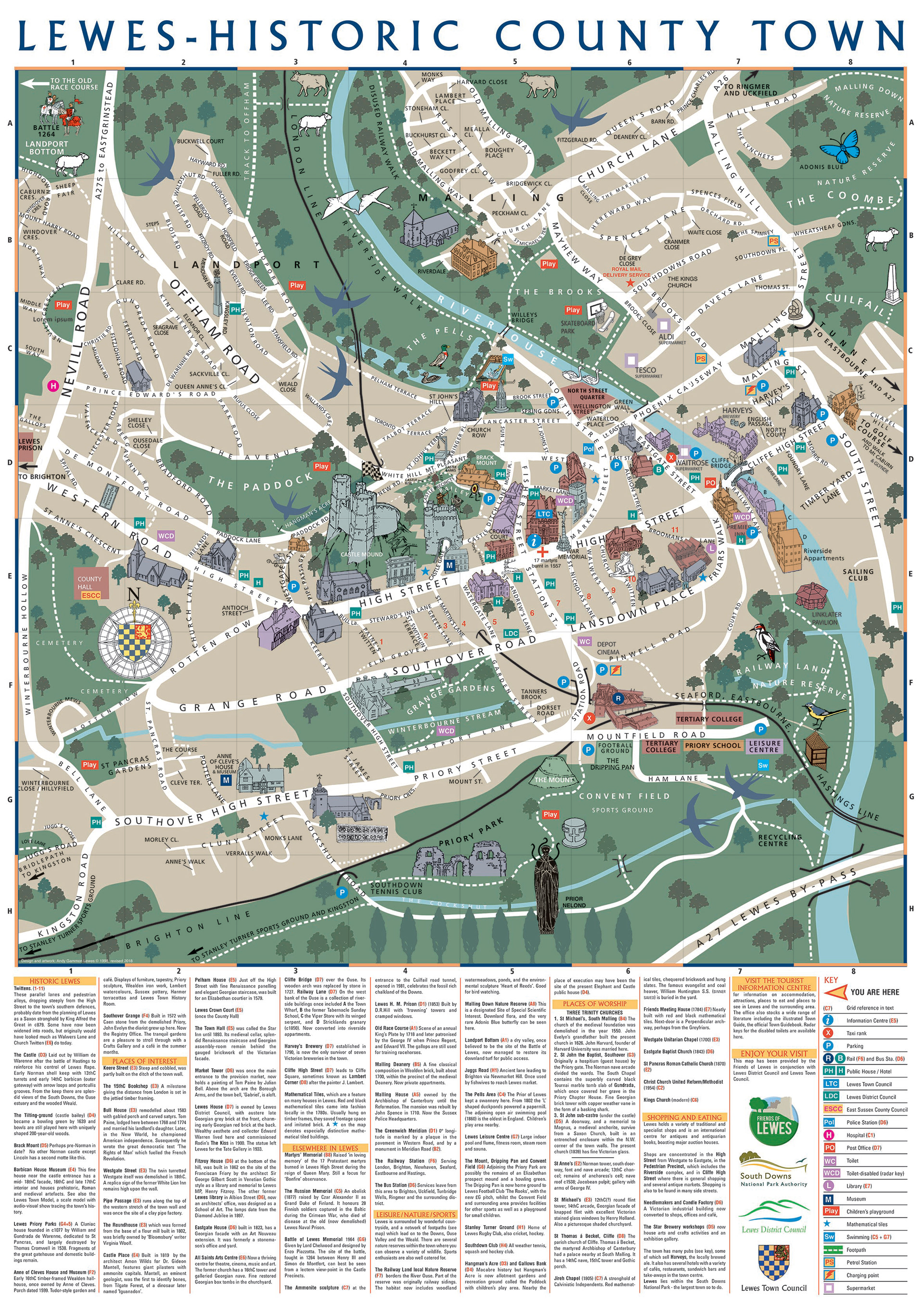
Lewes Town car park map with grid reference and gazetteer (size AI for external display)
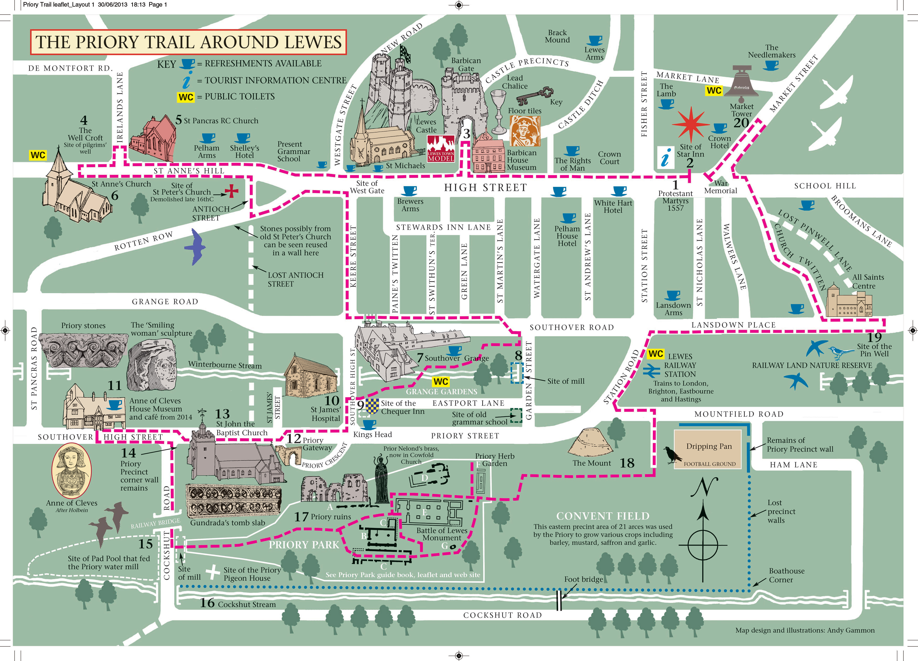
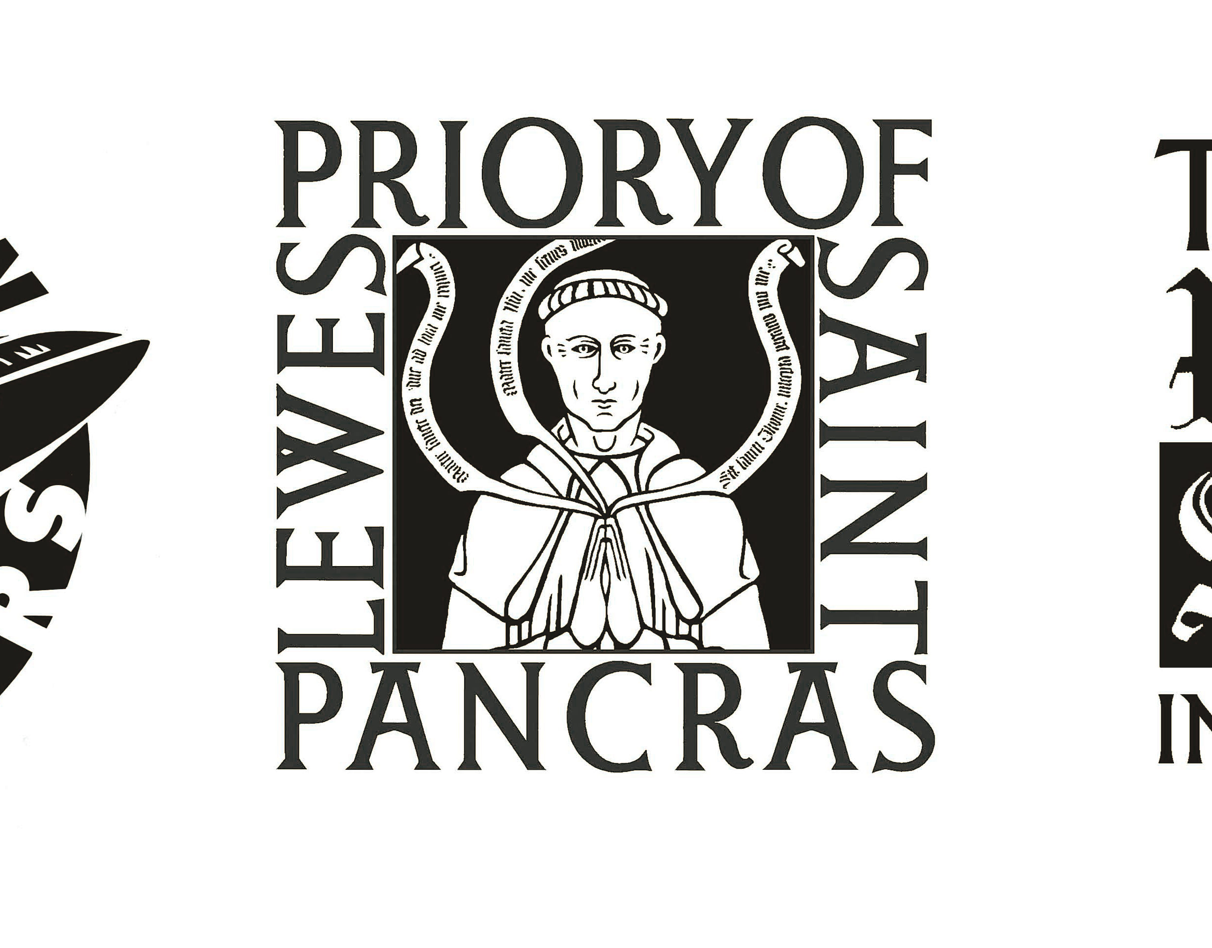
Lewes Priory trail around Lewes to identify Priory related items and sites
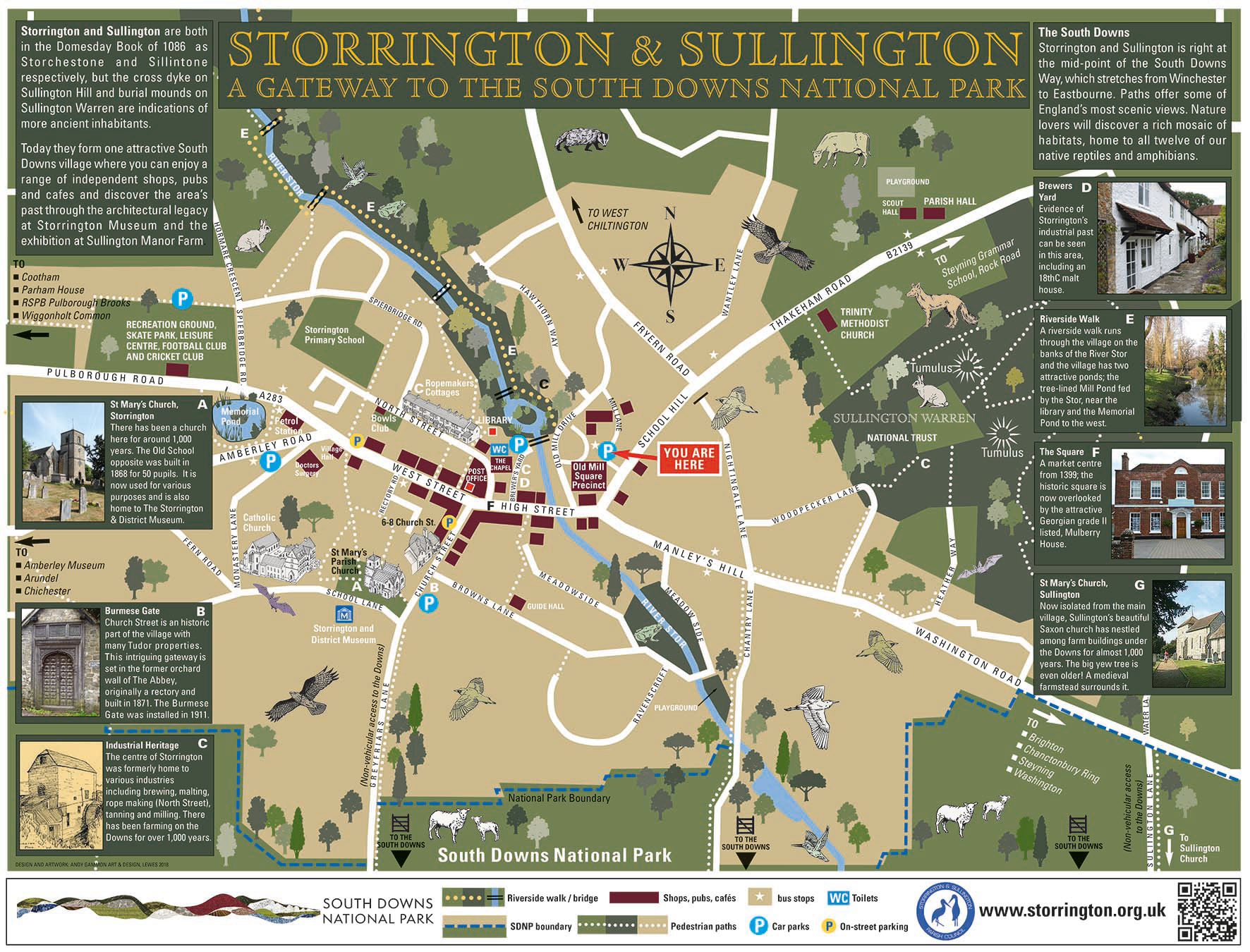
Storrington visitor car park map
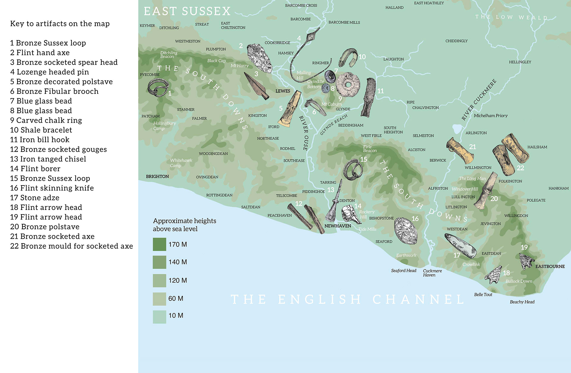
Prehistoric artifacts on the map of East Sussex, showing were found. designed for 1.2M panel at Newhaven Fort, Sussex. See the Archaeological Illustration section - Sussex Archaeology for more detail of the artefacts shown.
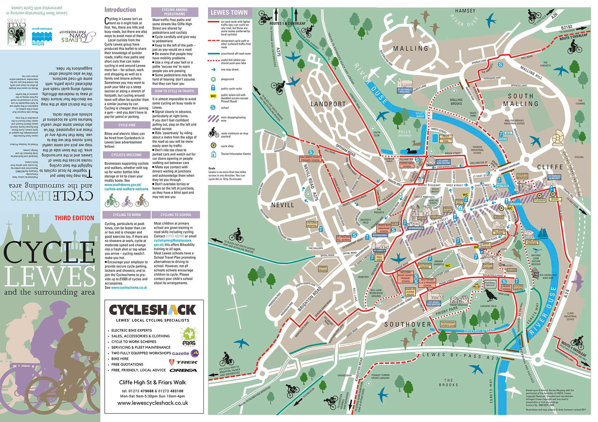
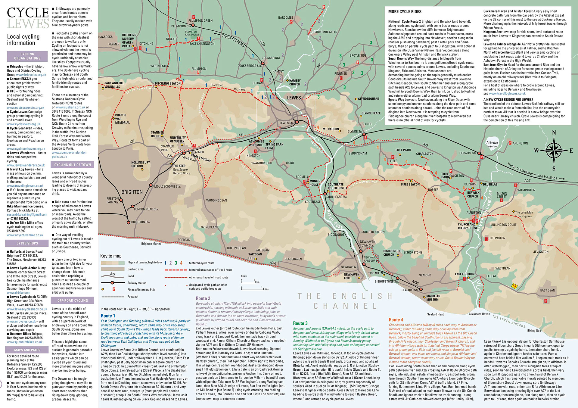
Side 1 (Town) and side 2 (countryside), of the Cycle Lewes map. Size A2 folding down to 1/3 A4

Lewes footpath map with connections to walks outside the town
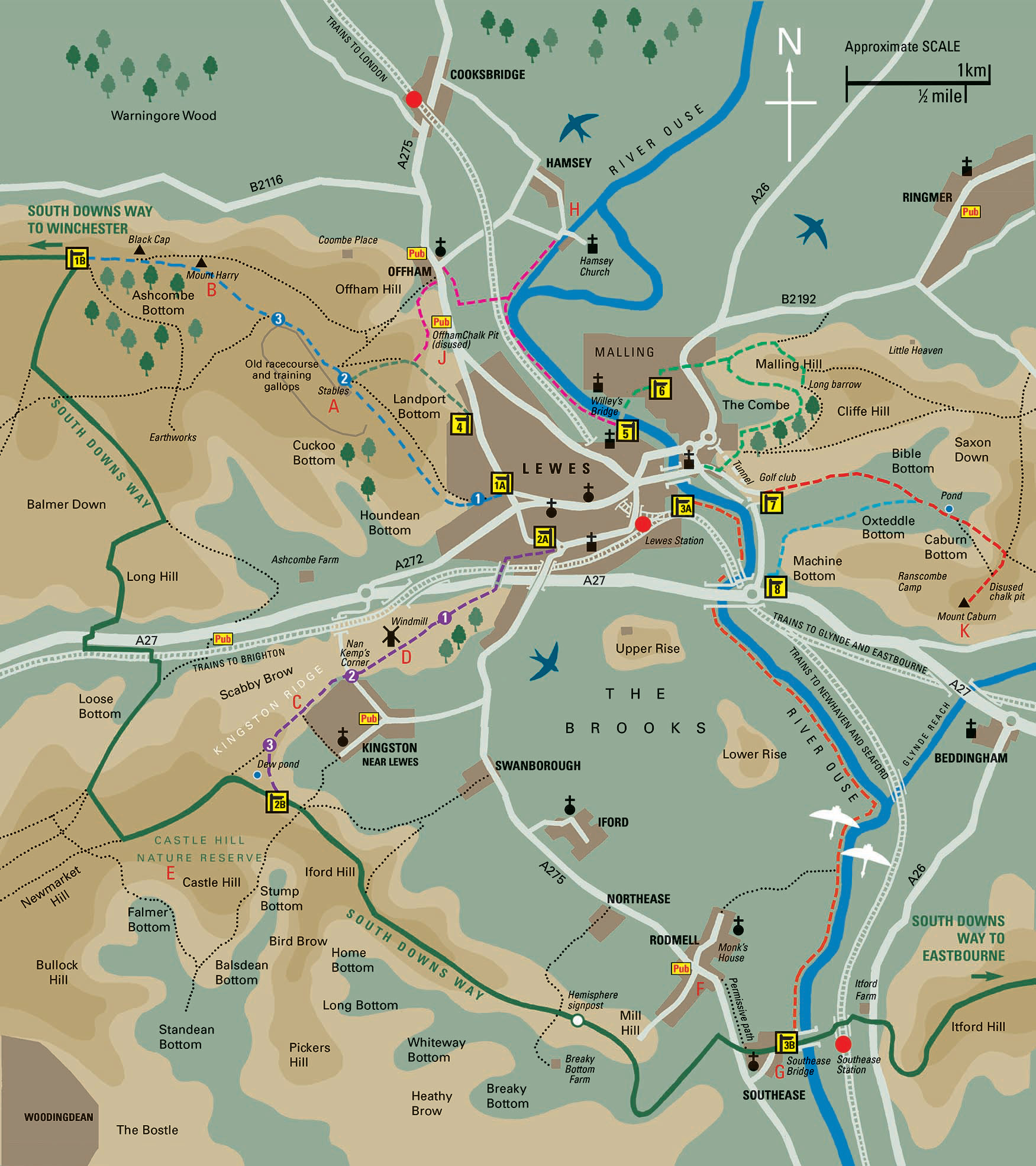
Lewes countryside footpath map
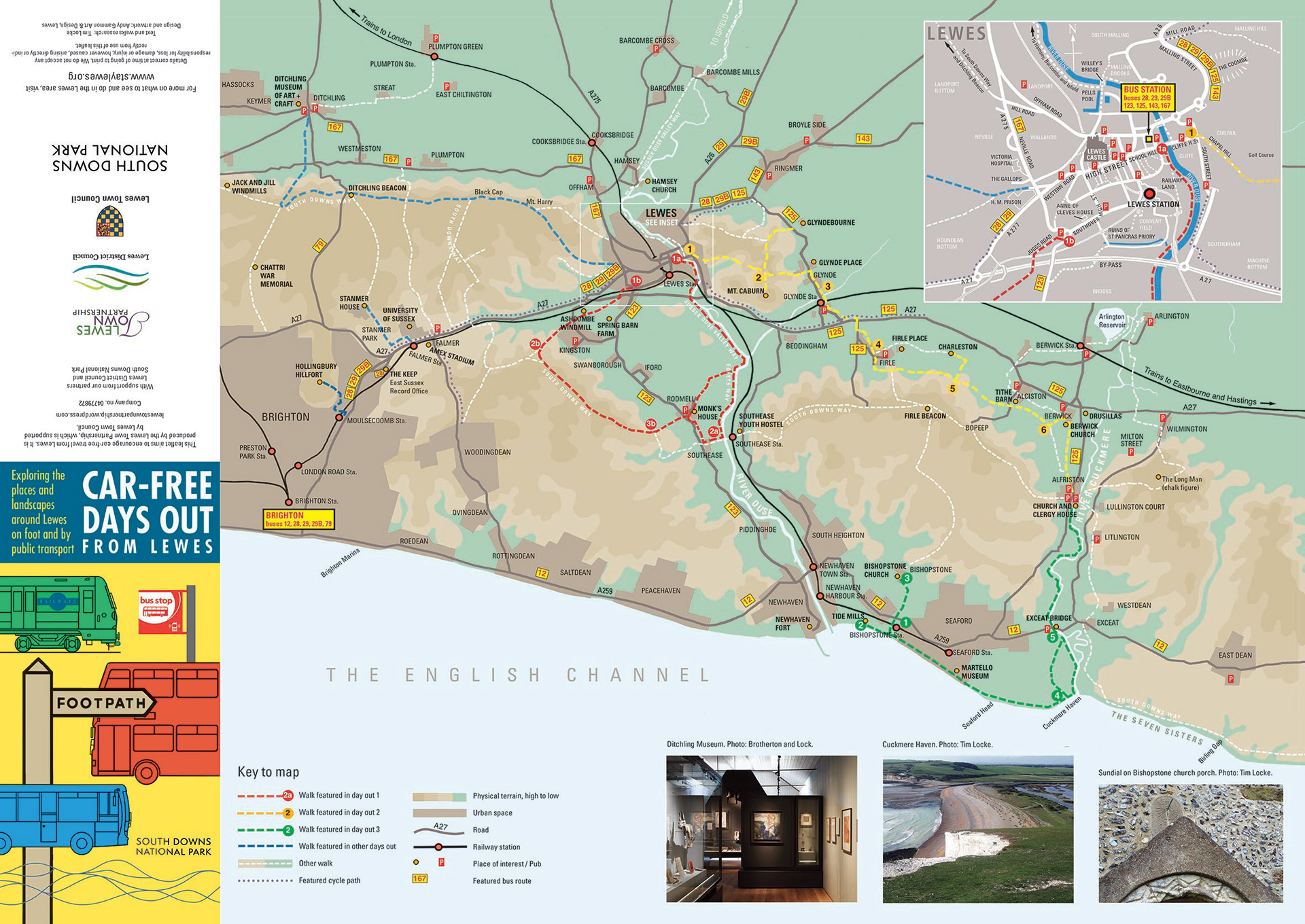
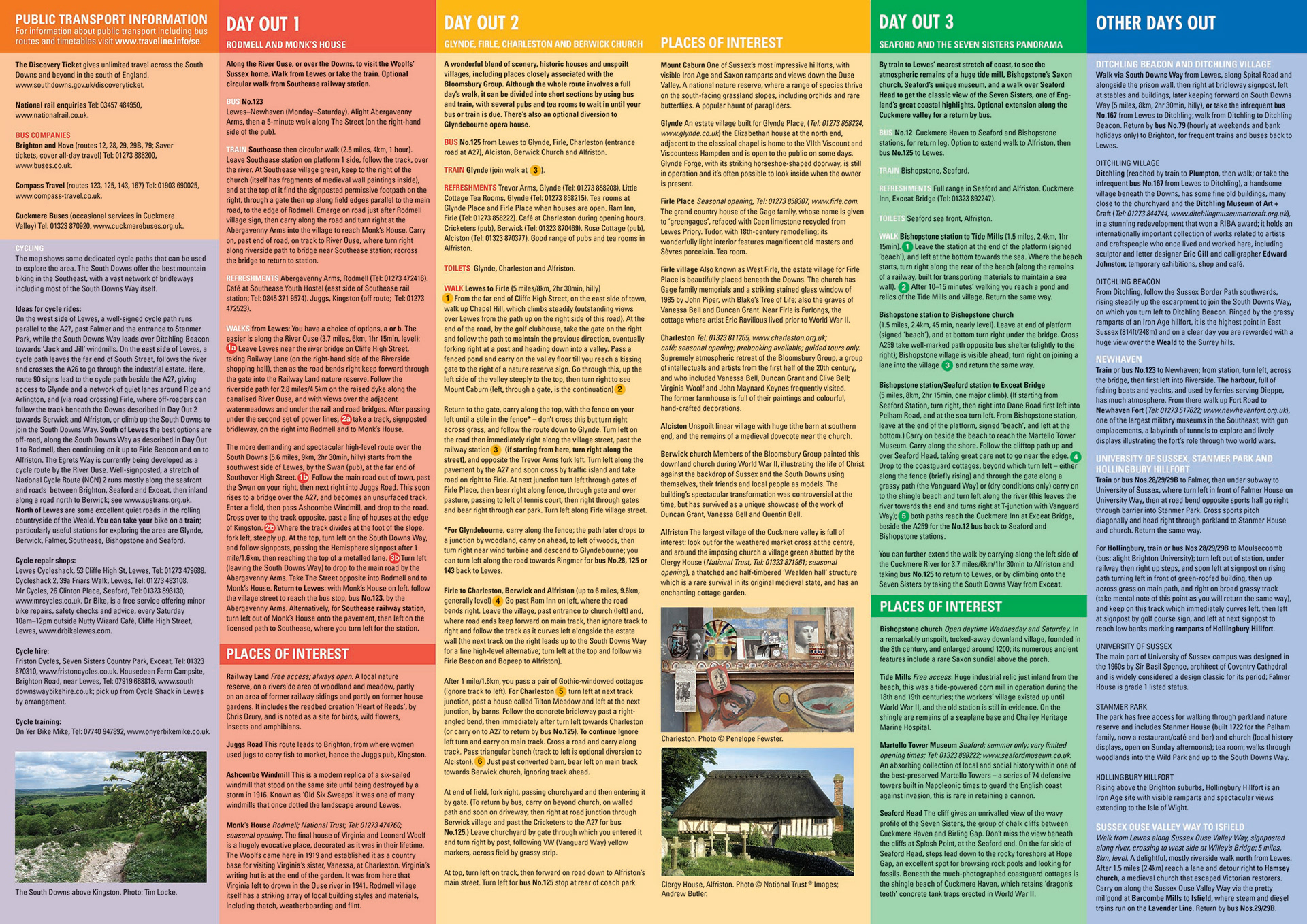
Lewes Car Free walks map with routes, timings, distances and places of interest featured on reverse. (A2 folds to 1/3 A4)
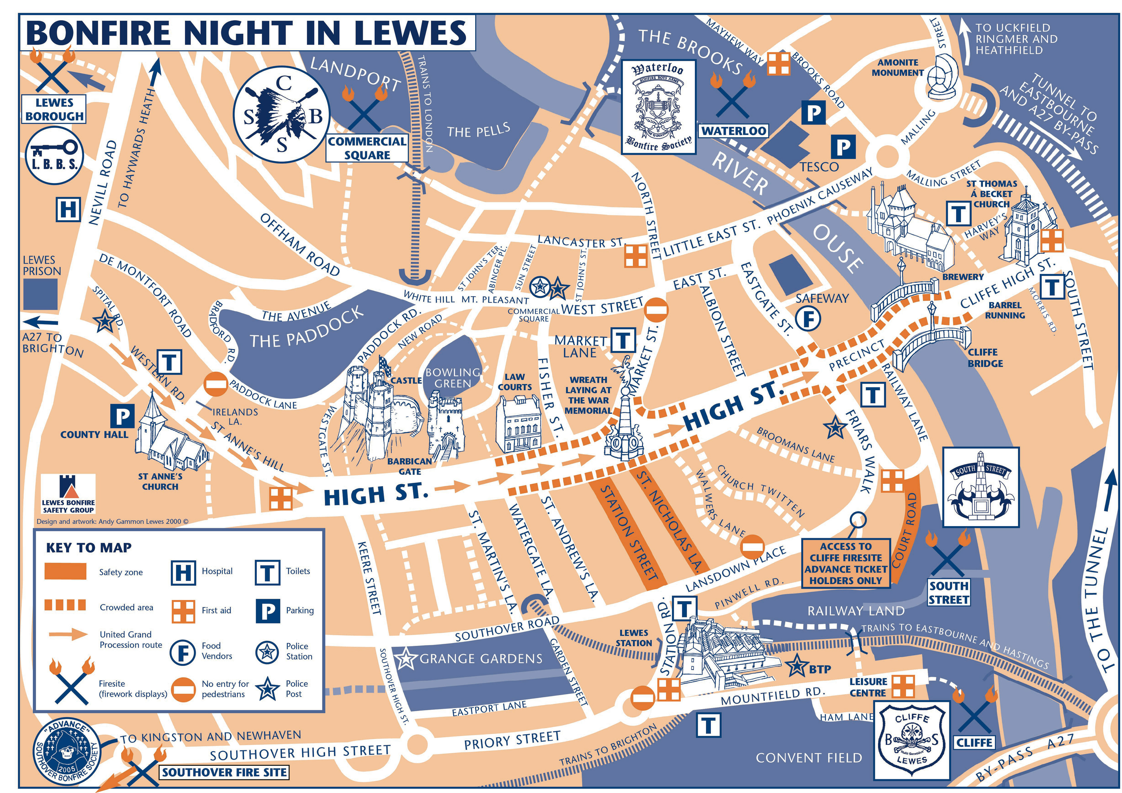
Map commissioned by Sussex Constabulary to help visitors orientate and stay safe on the night.
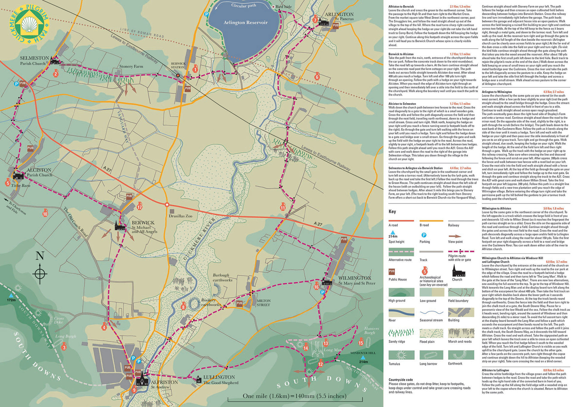
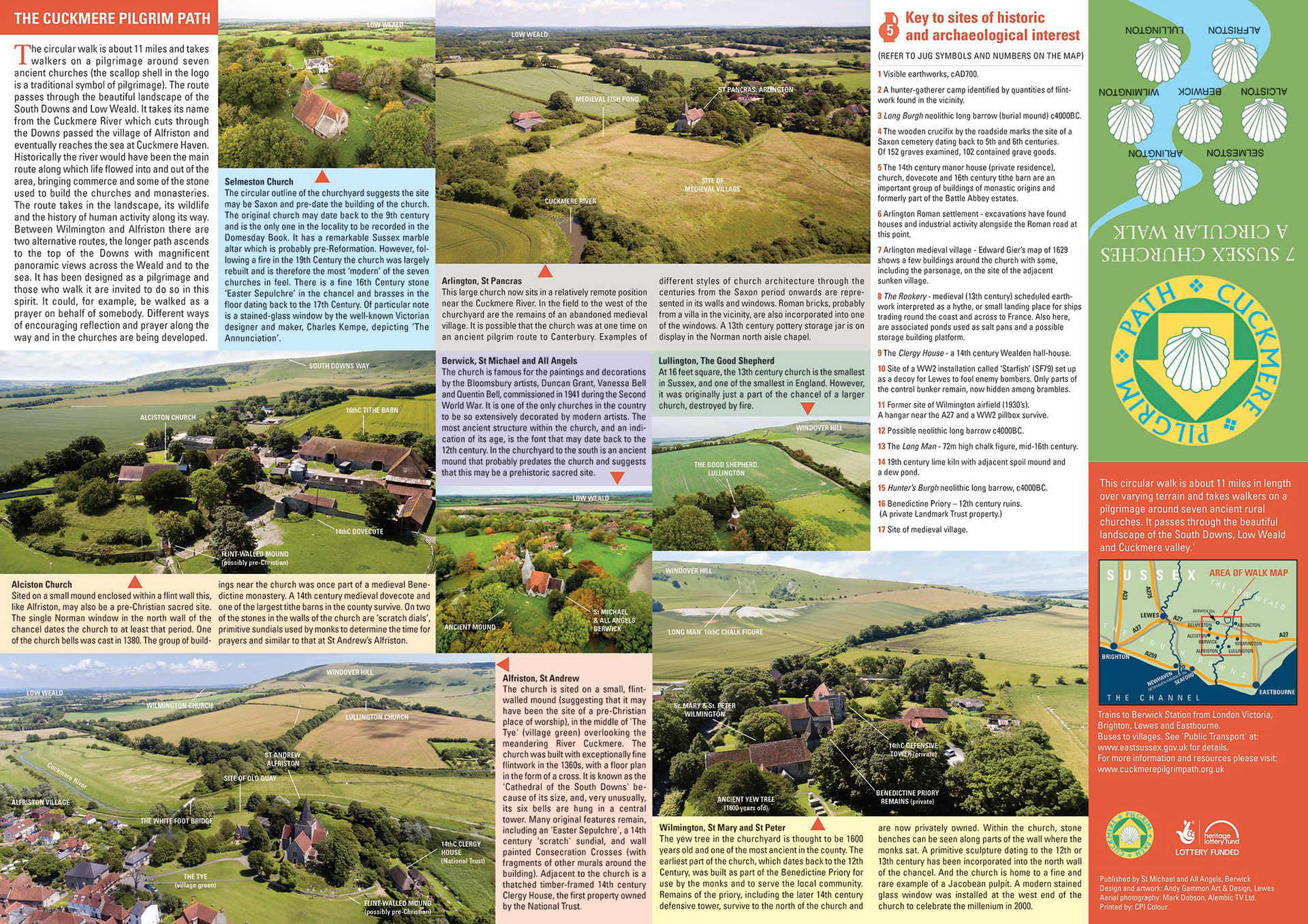
The Cuckmere Pilgrim Path map with a circular walk, centred on Berwick Church. It takes the walker/pilgrim around seven churches in Sussex within the exceptionally beautiful landscape and scenery of the South Downs and Lower Weald. The map is A2 and folds to 1/3 A4 with aerial photos and descriptions on the reverse side.
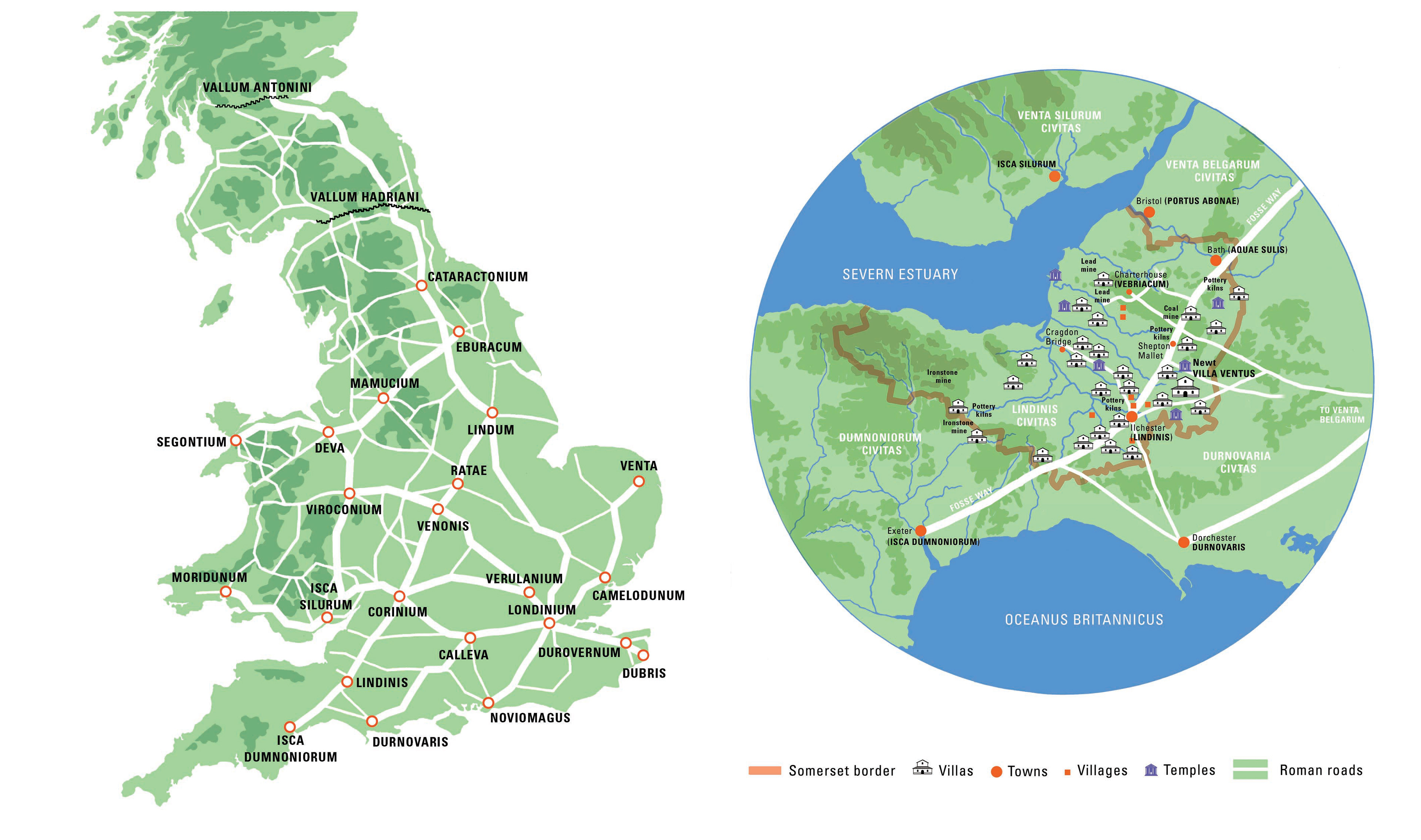
Roman roads in Britain with a detail of the Somerset region near Villa Ventus. Commissioned by the Dutch design company, Kossmanndejong, for an interpretation scheme at the reconstructed Roman Villa, at Newt Somerset.