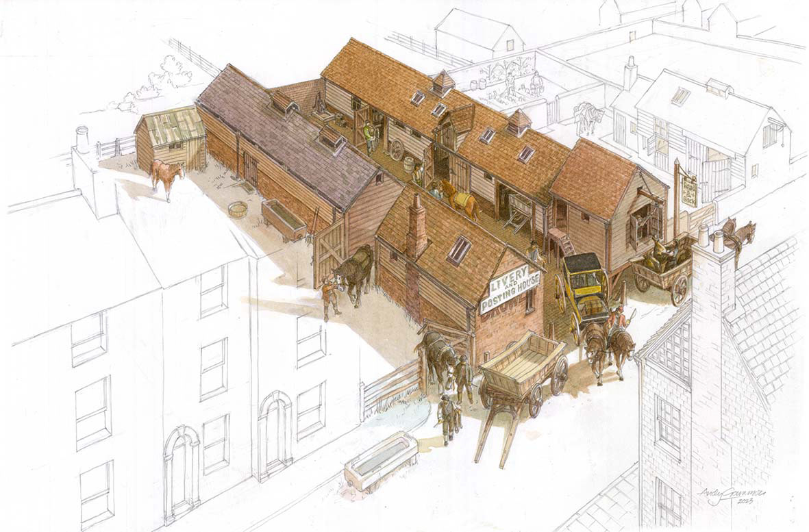
A site in Market Street, Lewes, as it was in 1837, and known then as 'Market Street Mews'. I was used as a Posting House and stables prior to the current occupiers, George Justice, furniture restorers, since the early 1900s..
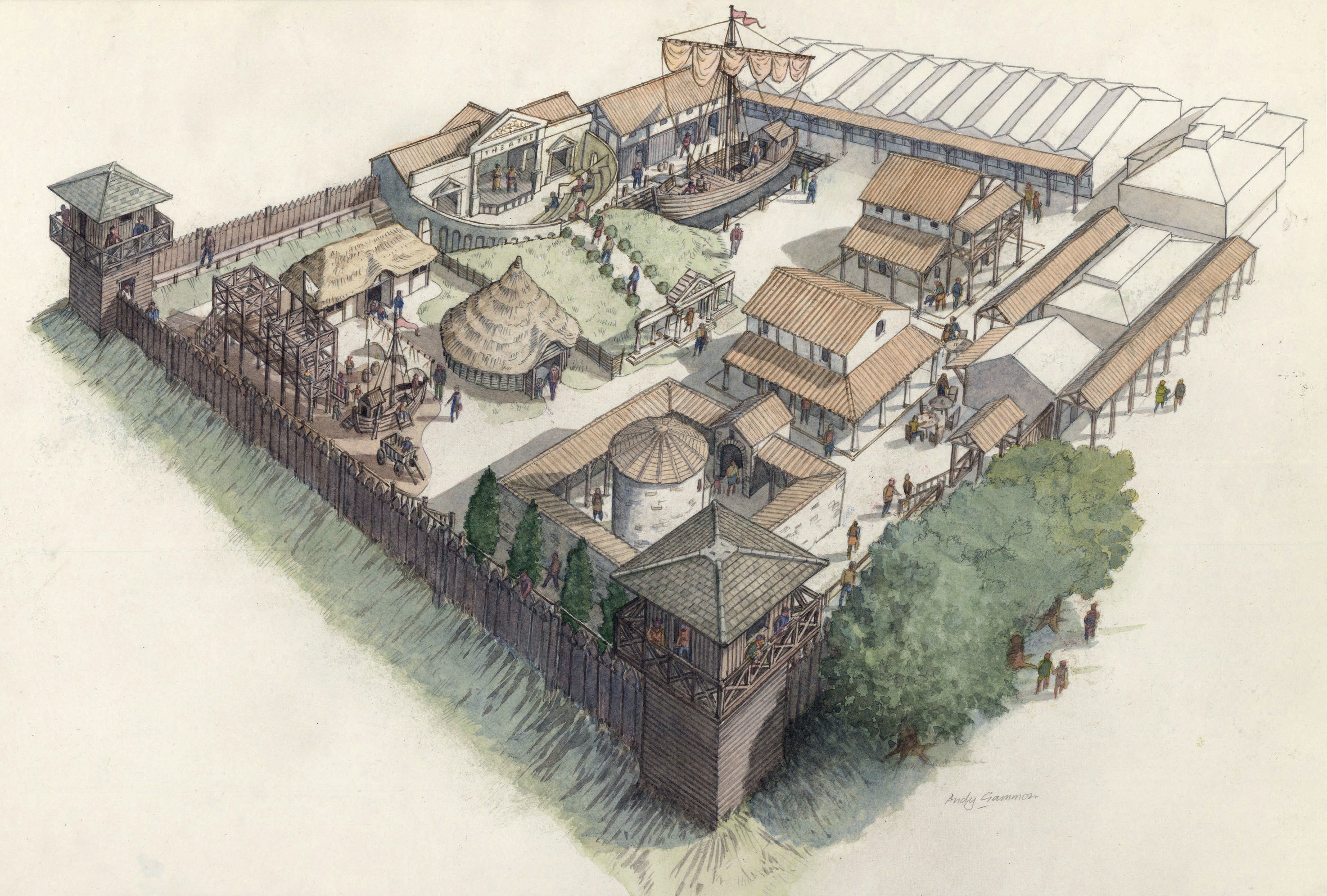
Fishbourne Roman Palace Museum: An impression of a proposed outdoor themed display area, commissioned by the Sussex Archaeological Society.

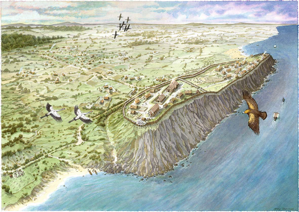
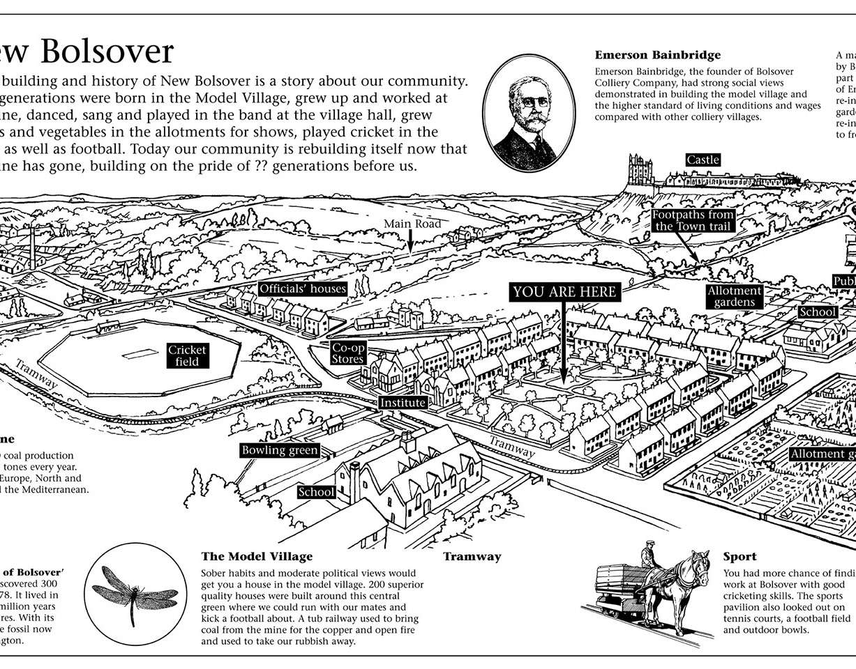
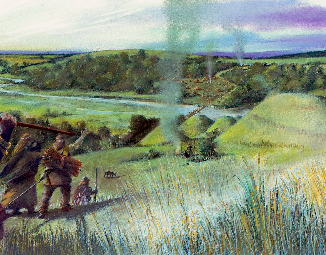
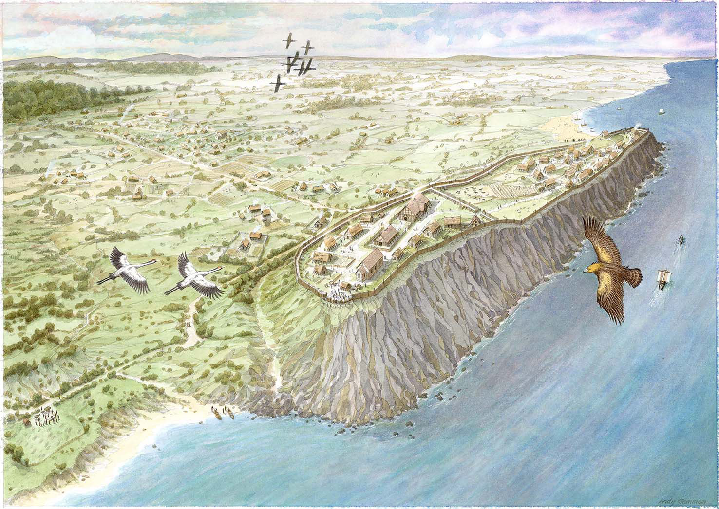
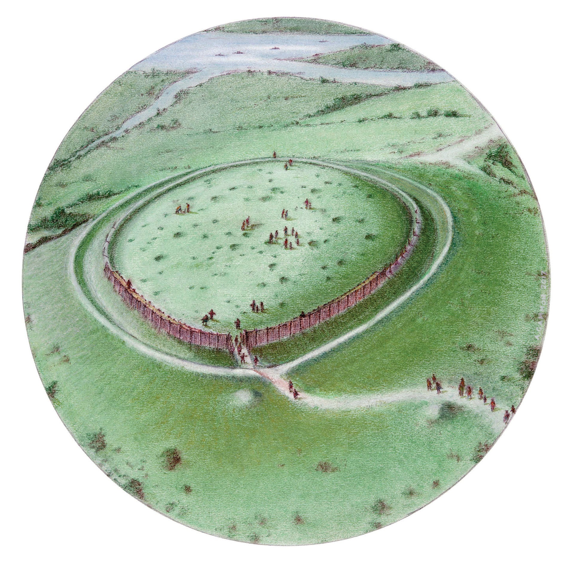
The site of Banburgh Castle in Saxon times.
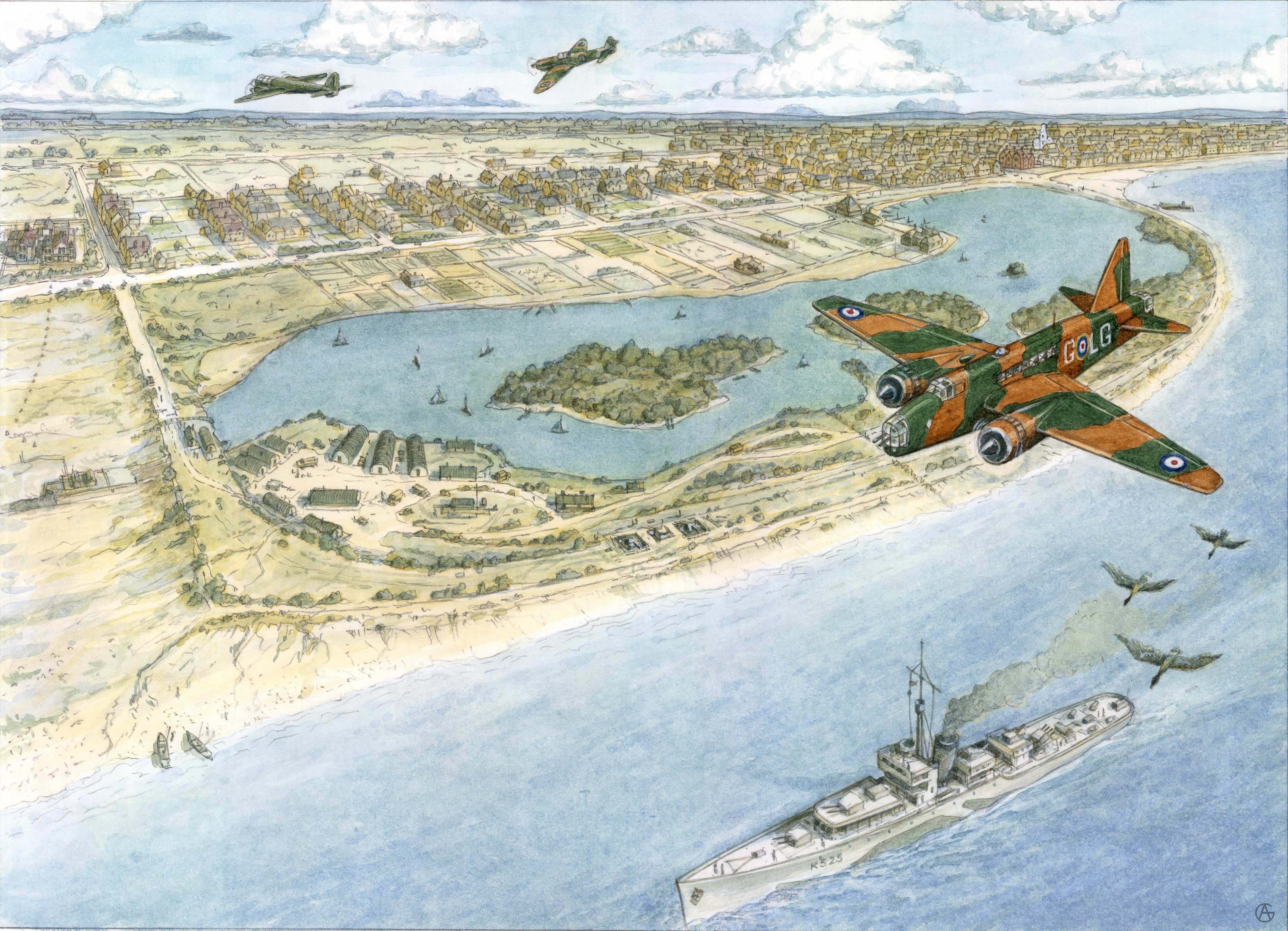
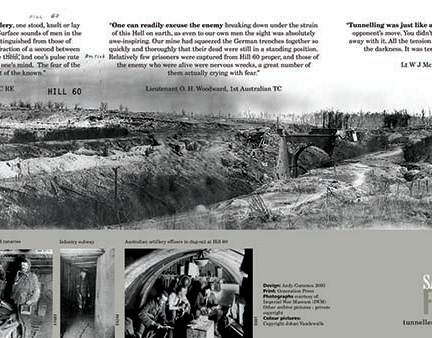
Wartime view of Fairhaven pleasure lake with coastal defence batteries in 1940.
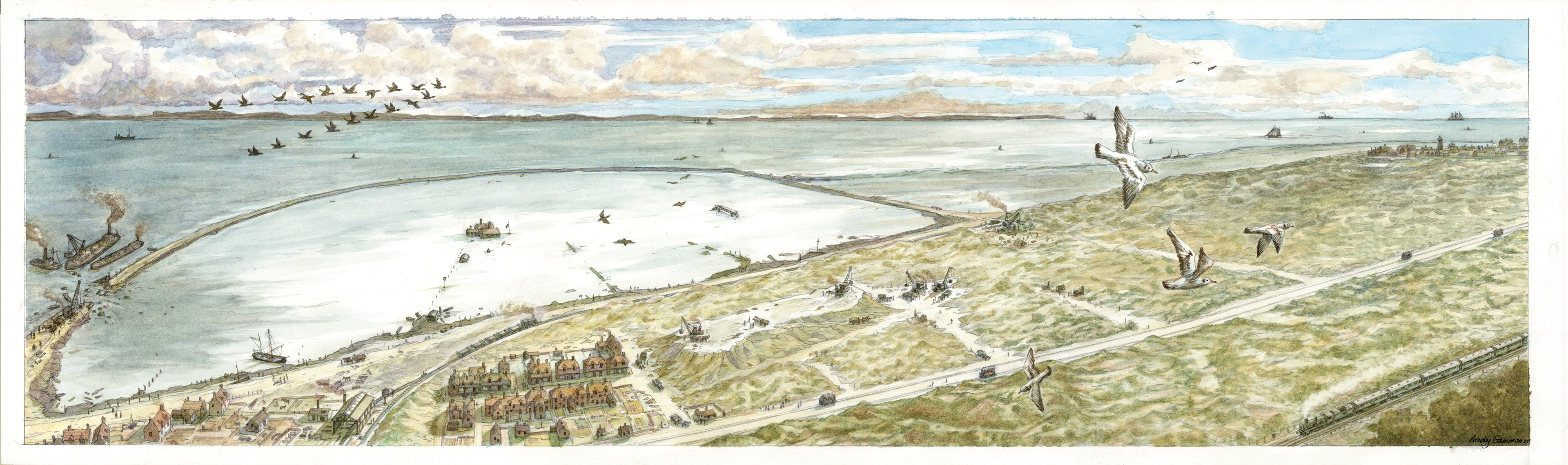
The Fairhaven flood of 1896
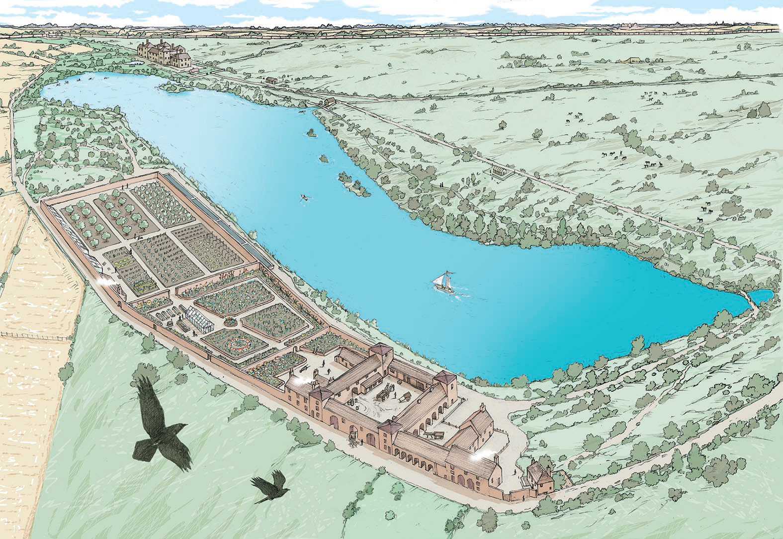
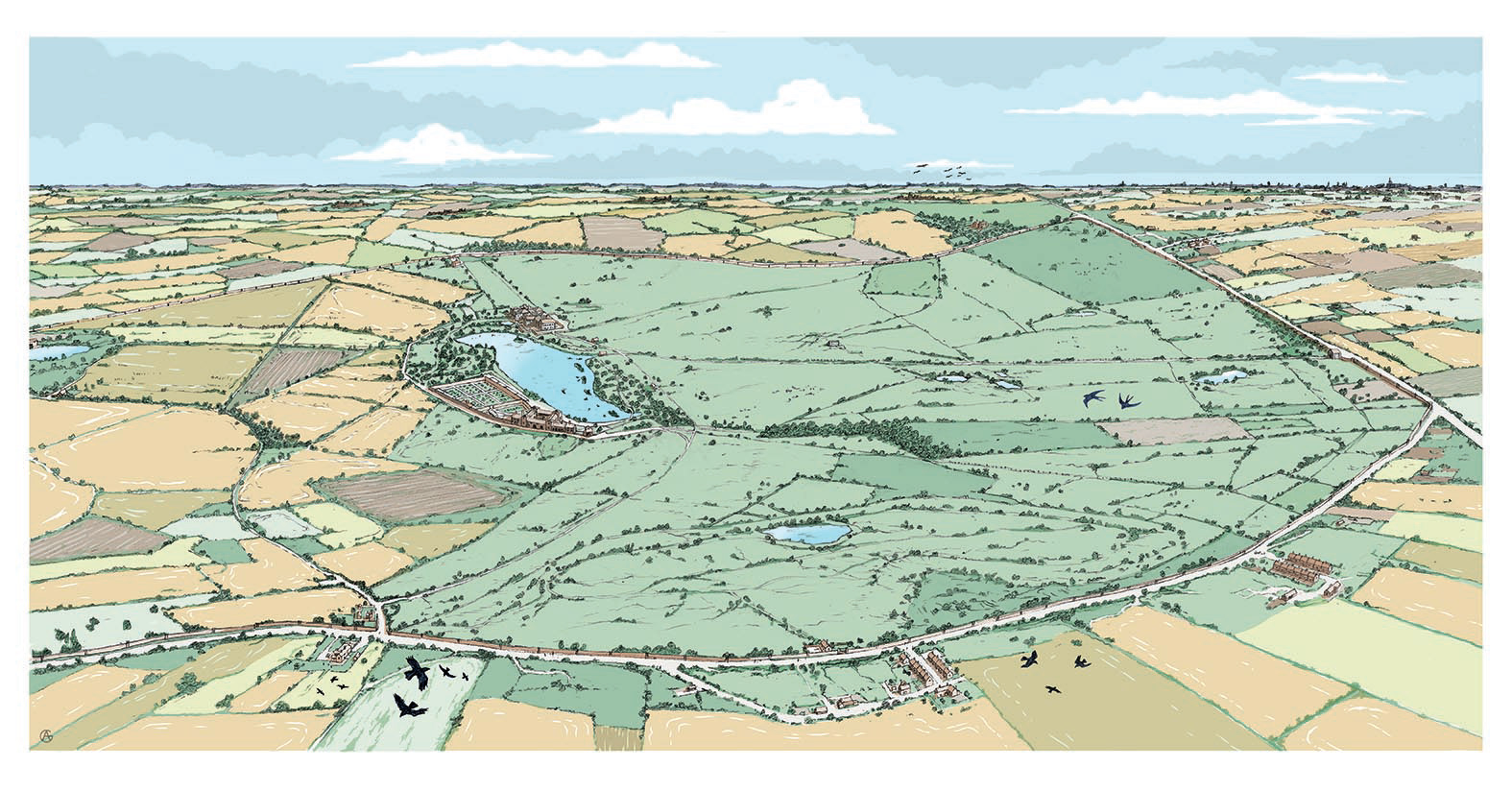
Historic interpretation of Sandwell Park near West Bromich, Birmingham. Showing the view of the park in 1850 with a close up view (above) over the farm buildings, garden and lake.
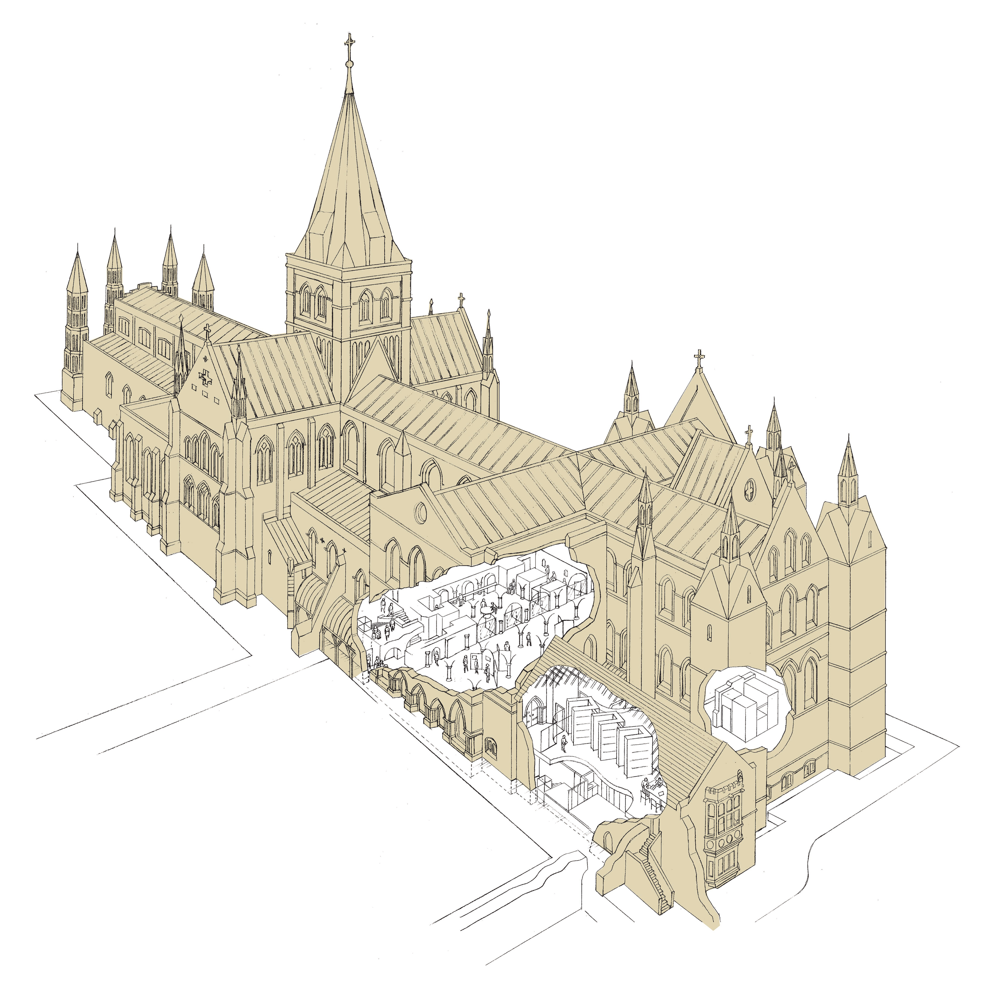
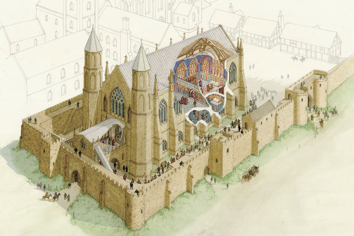
Rochester Cathedral cut-away produced for an on-site museum display and associated promotional literature.
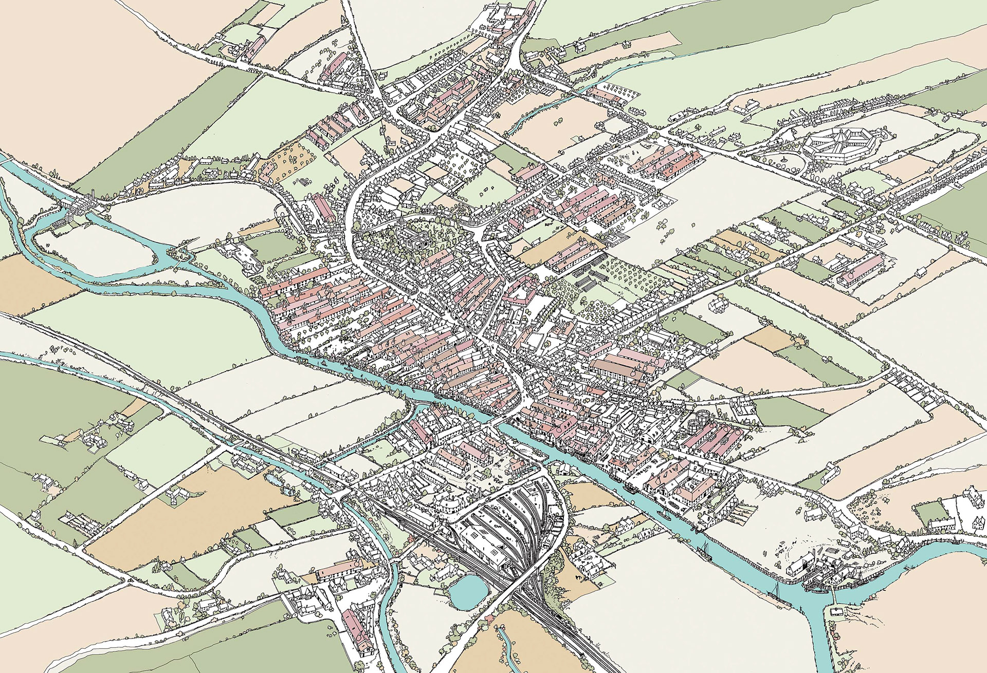
Aerial view of Ware, Hertfordshire, showing the extent of the malting barns (long red roofs) that served the brewing industry. It shows the nearby River Lee, which was used to barge the malted barley direct to the breweries in the heart of London - This illustration was used on a display panel in the Ware Arts Centre, Maltings Museum.
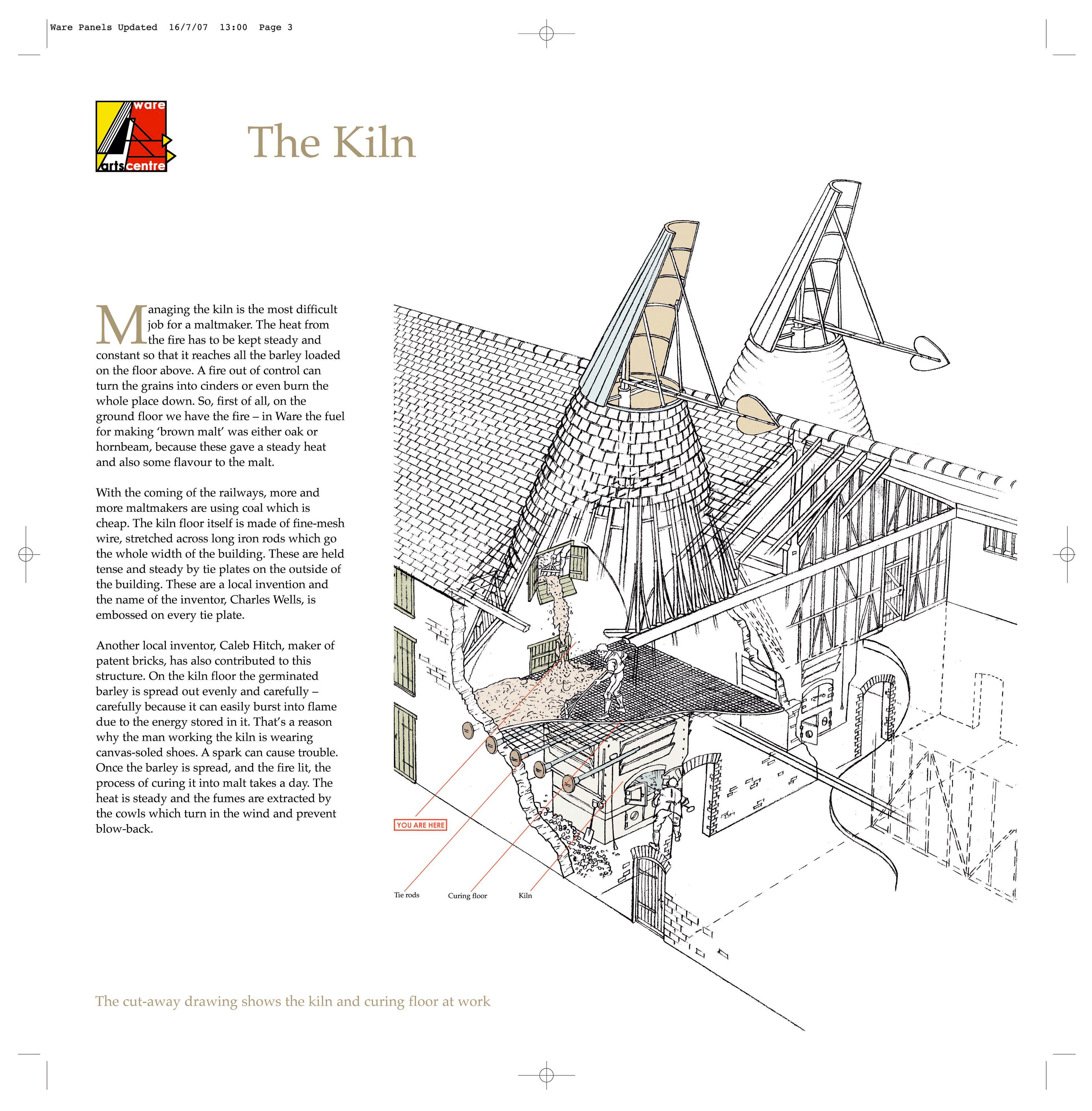
One of the panels in the Ware Arts Centre Maltings Museum showing a cut-away illustration reconstructing what the kiln and drying area in the malting barn would have looked like in the late 19thC.
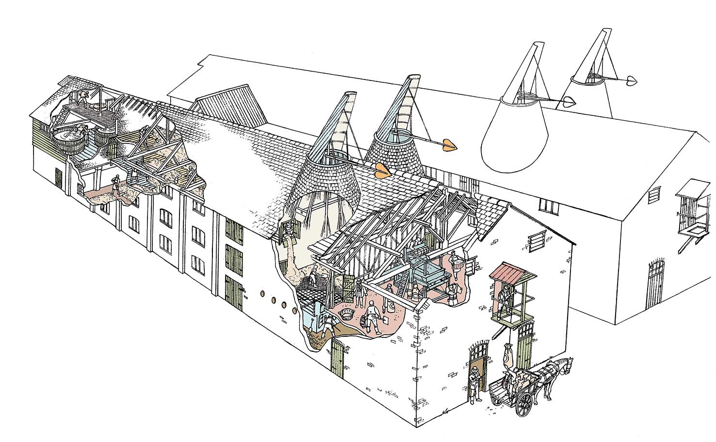
Aerial view and cut-away of the malting house at Ware. Part of the display at Ware Art Centre
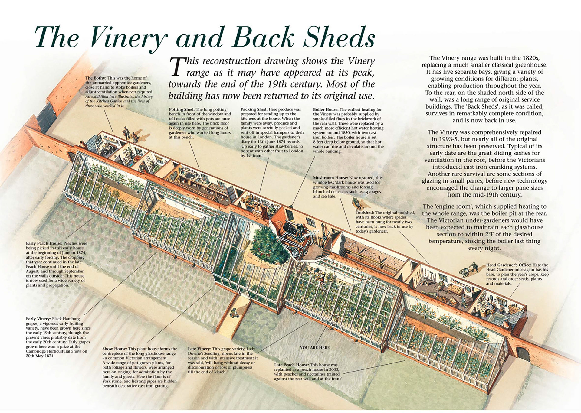
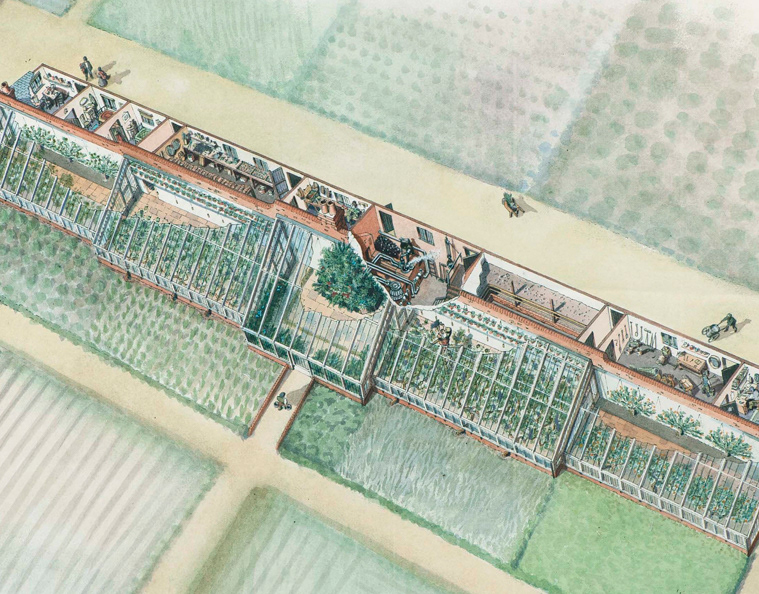
Audley End Vine and Peach House showing the bothy, potting shed, packing shed, boiler house, mushroom house, tool shed and head gardener's office on the other side of the central 'hot' wall.
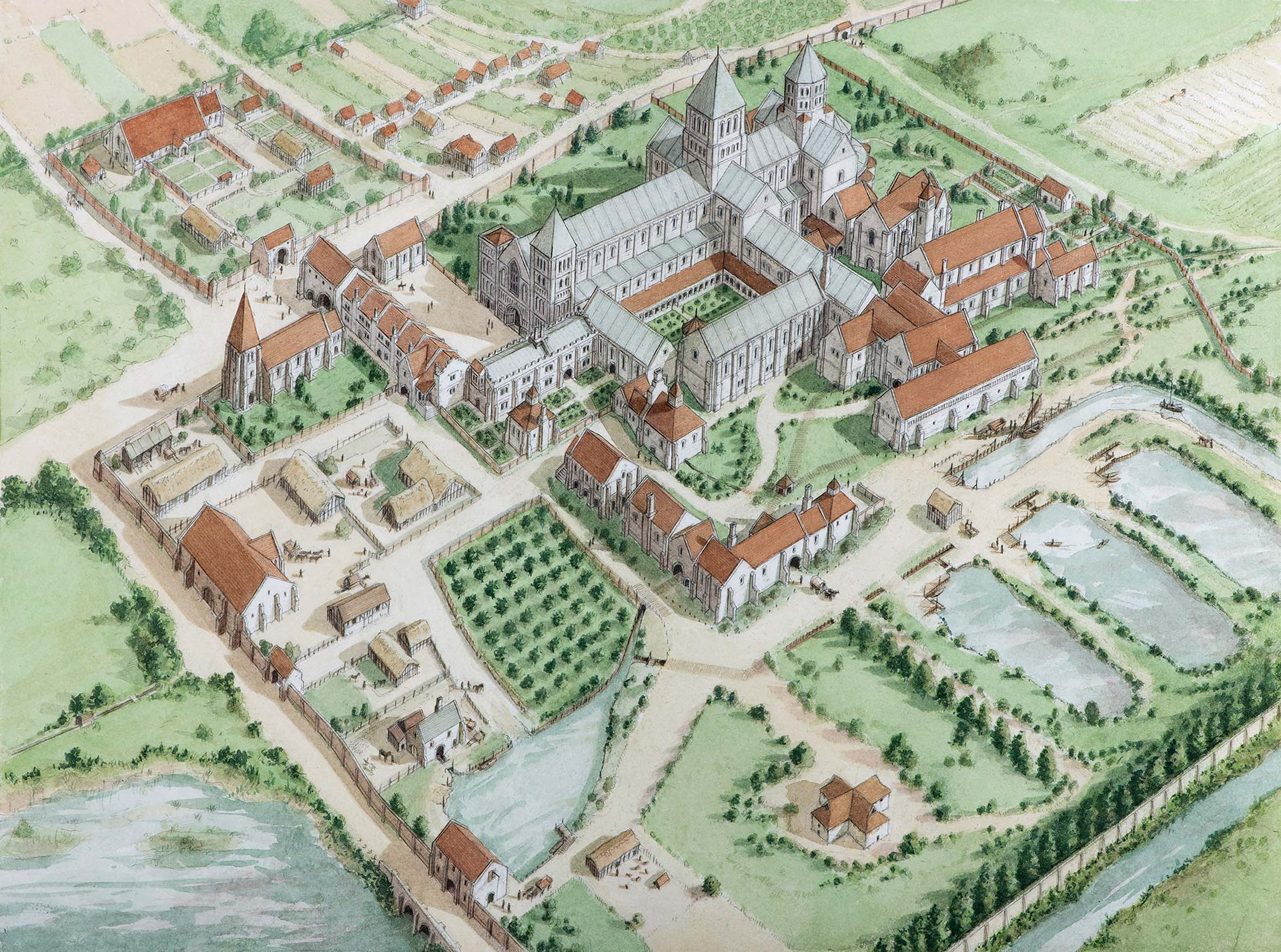
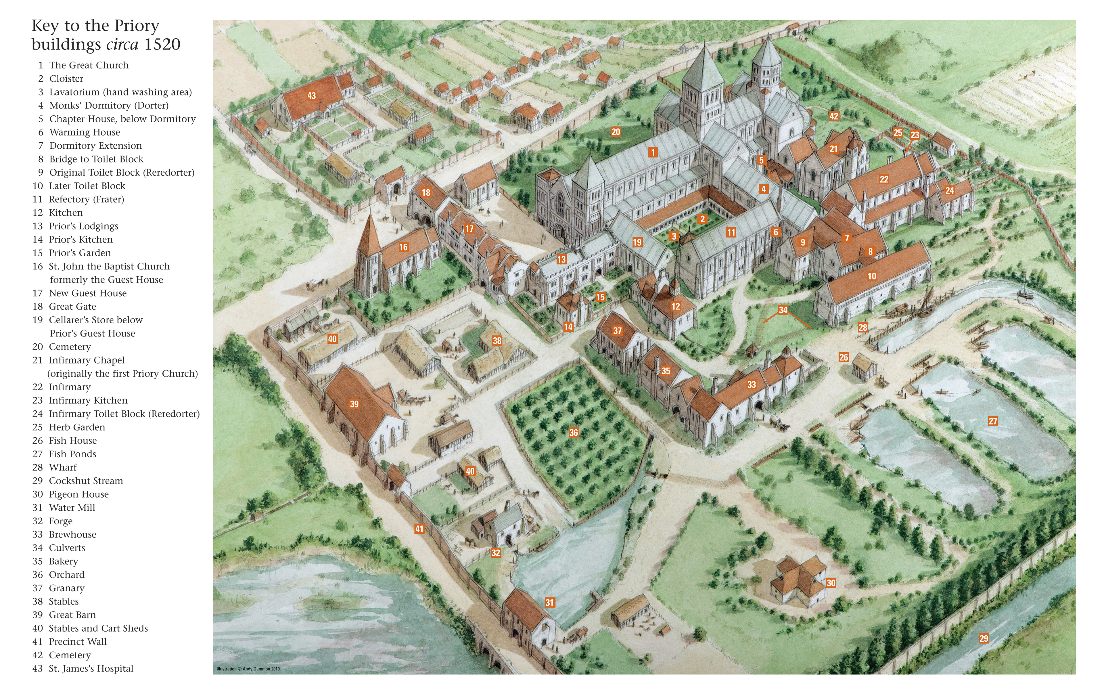
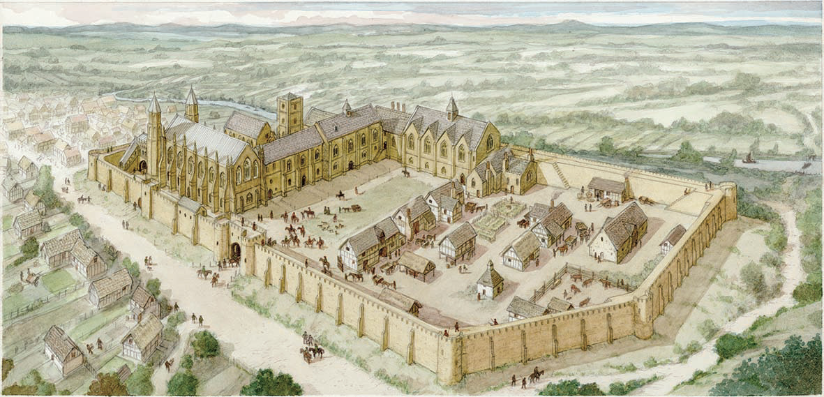
Lewes Priory from the west as it may have looked c1520, prior to the Reformation.
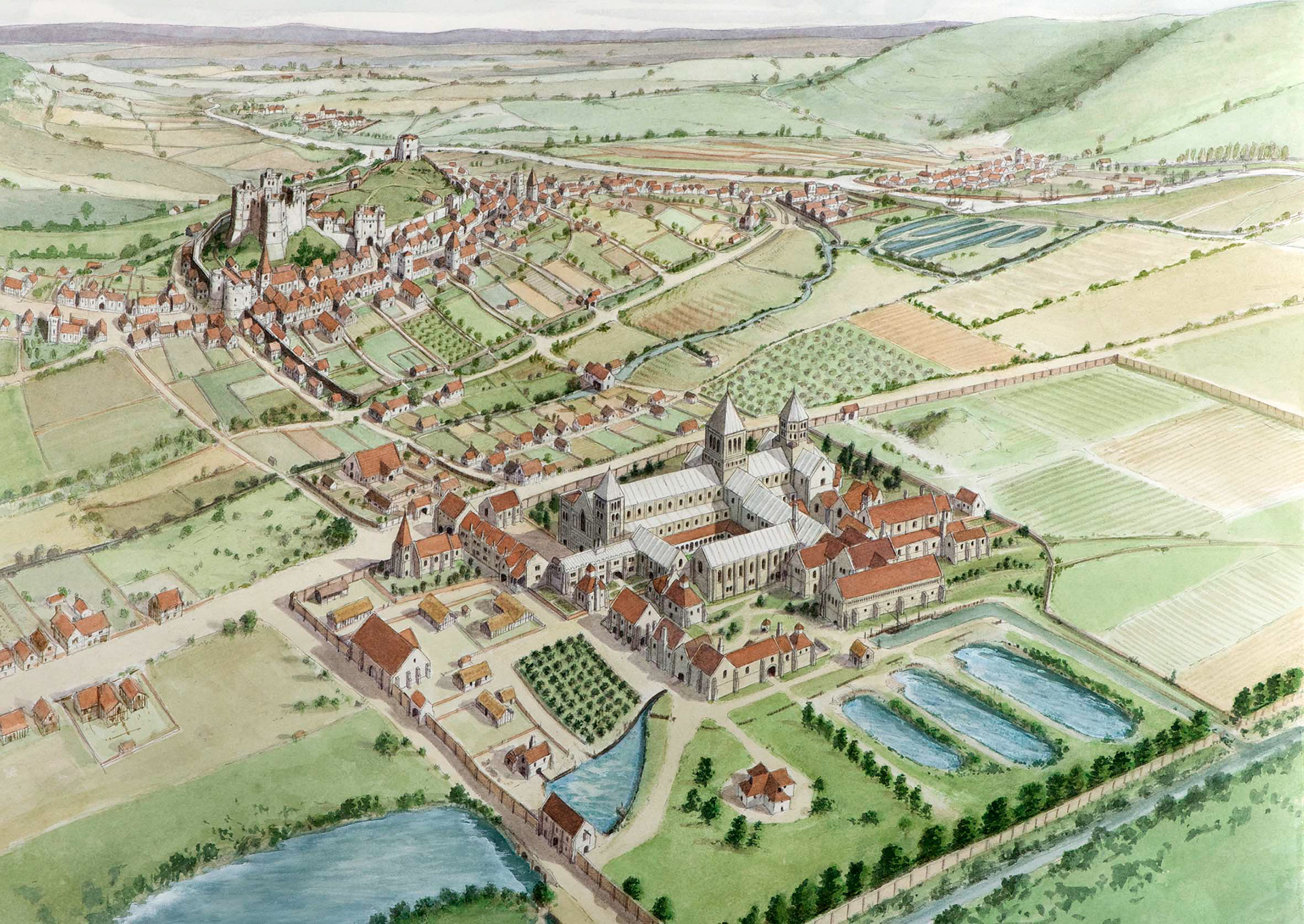
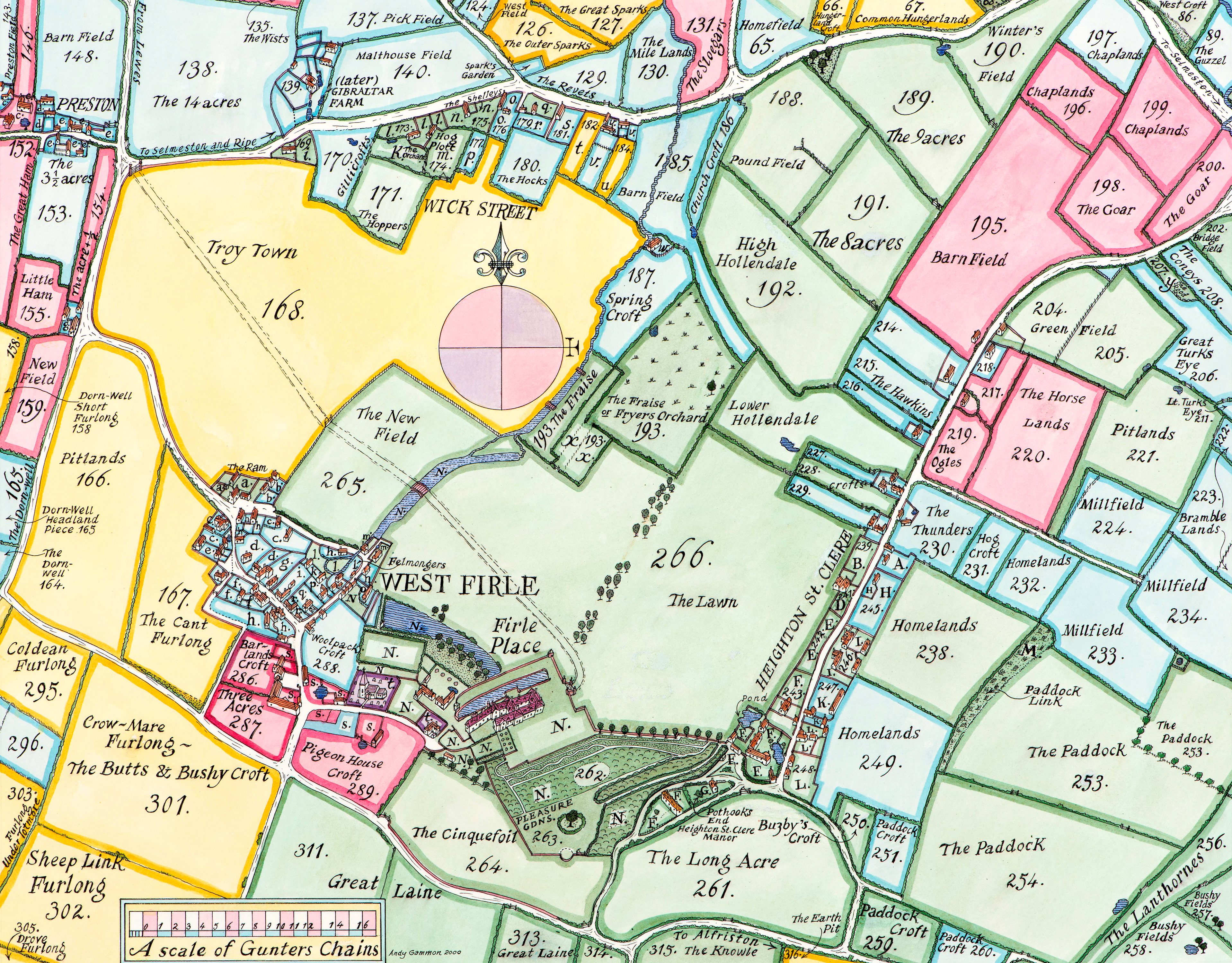
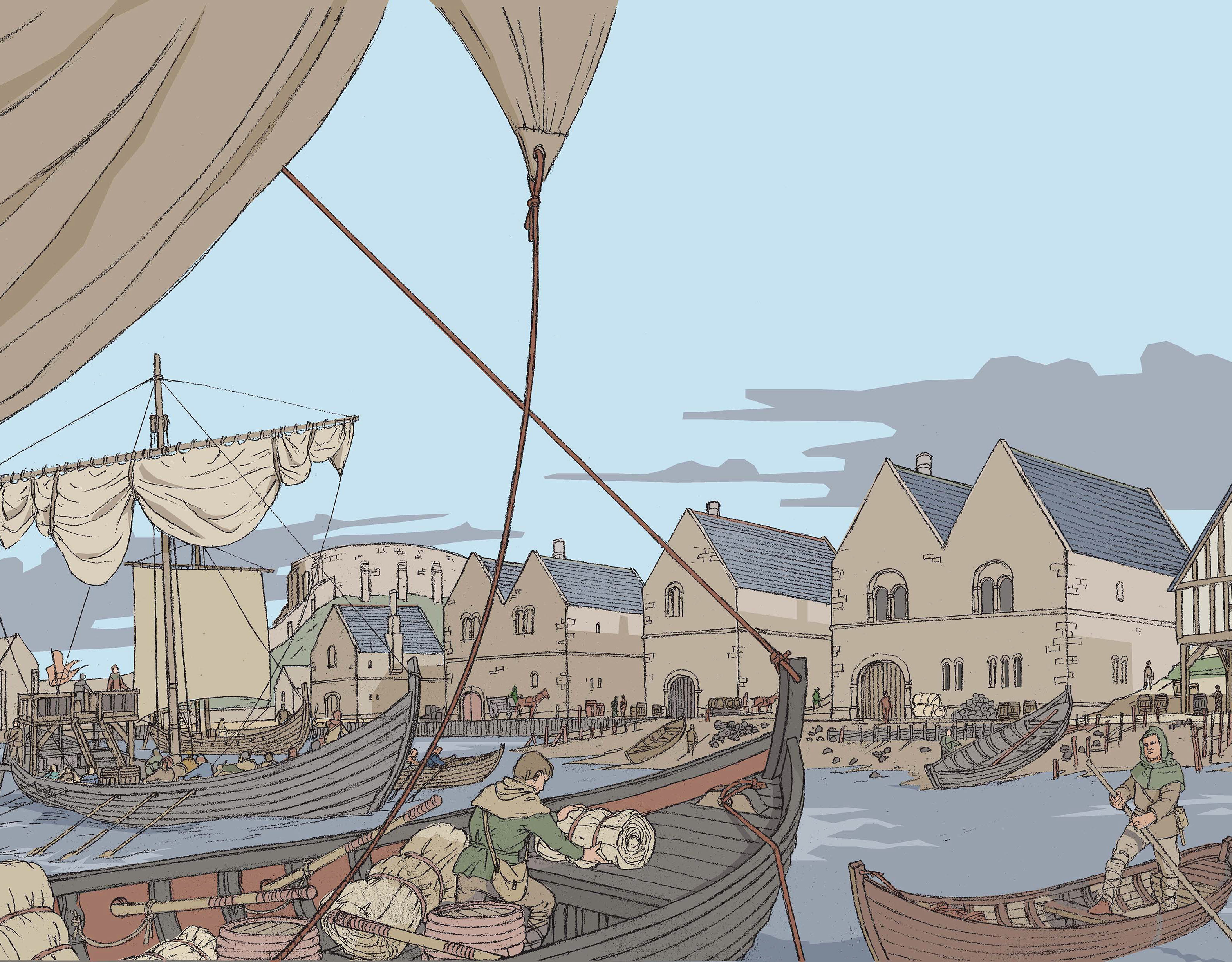
Lewes Priory seen from the south west showing the town of Lewes, its castle and west gate, also the River Ouse snaking north with the parish of Cliffe on the east bank below Malling Down.
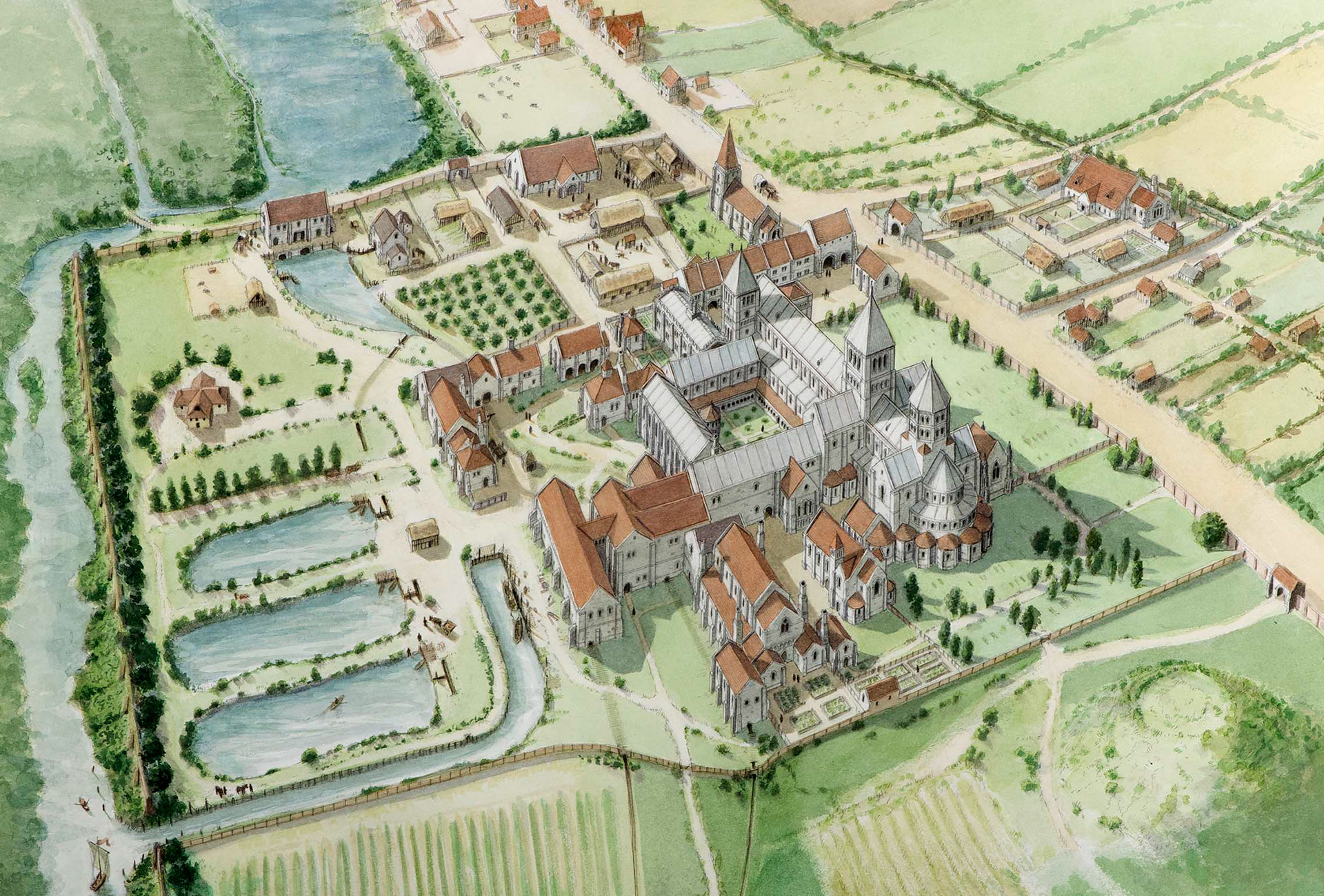
Lewes Priory seen from the east, c1520, showing the Cockshut Stream diverted around the southern boundary, the pad pool to the west that fed the mill ponds, and Southover High Street along the northern edge. This and the previous illustrations formed part of the Lewes Priory Park interpretation project which includes twelve illustrated panels for visitor information.
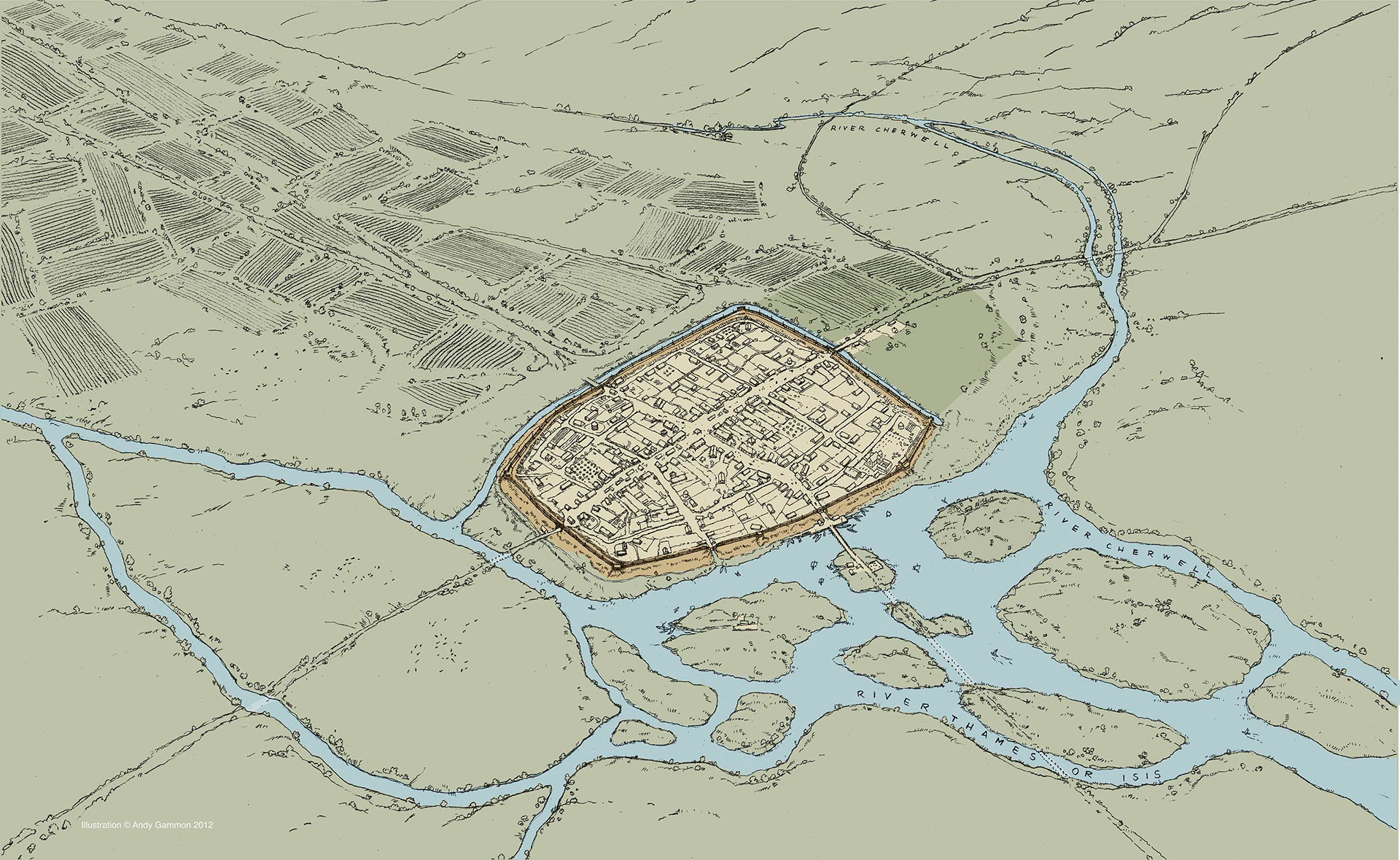
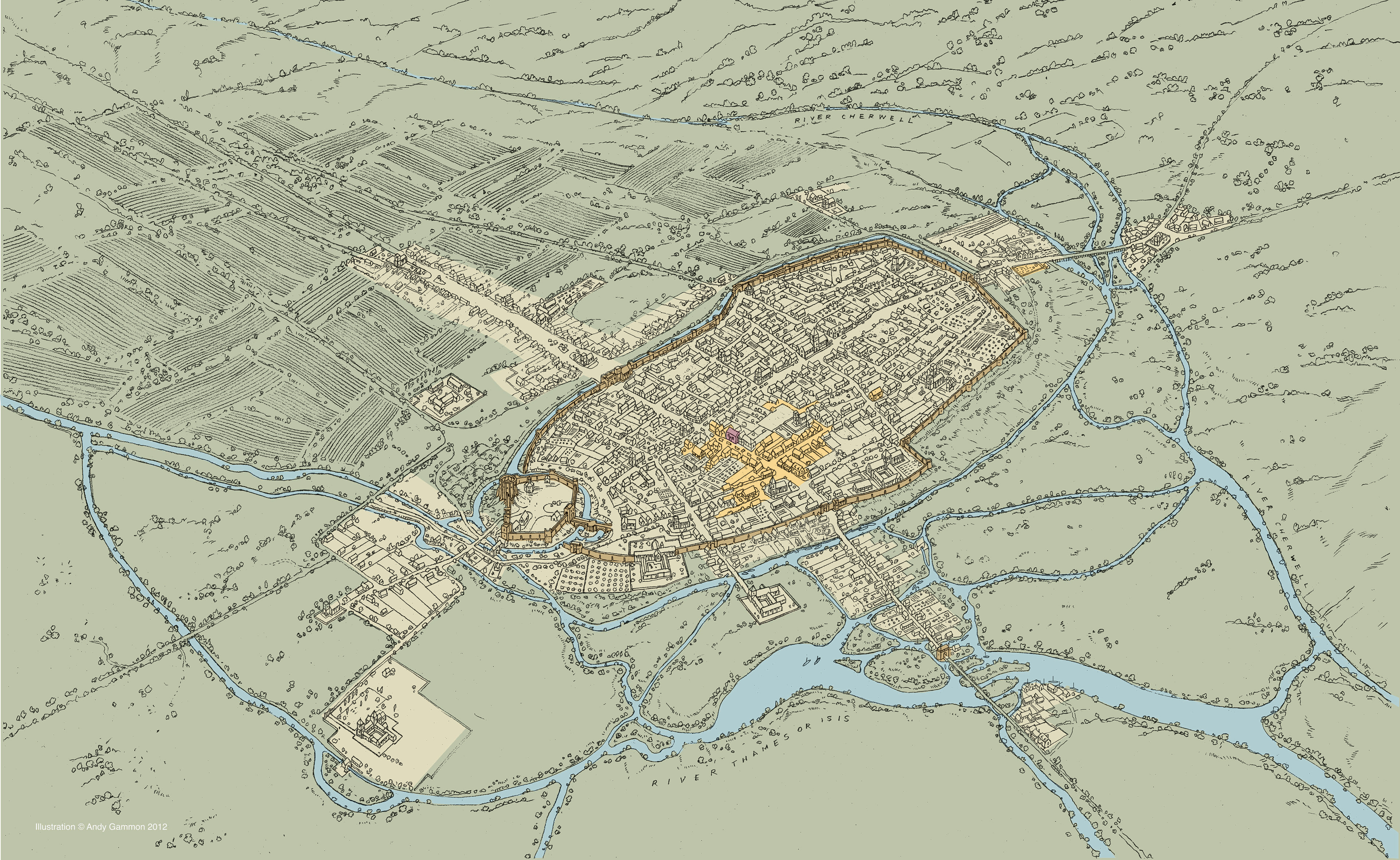
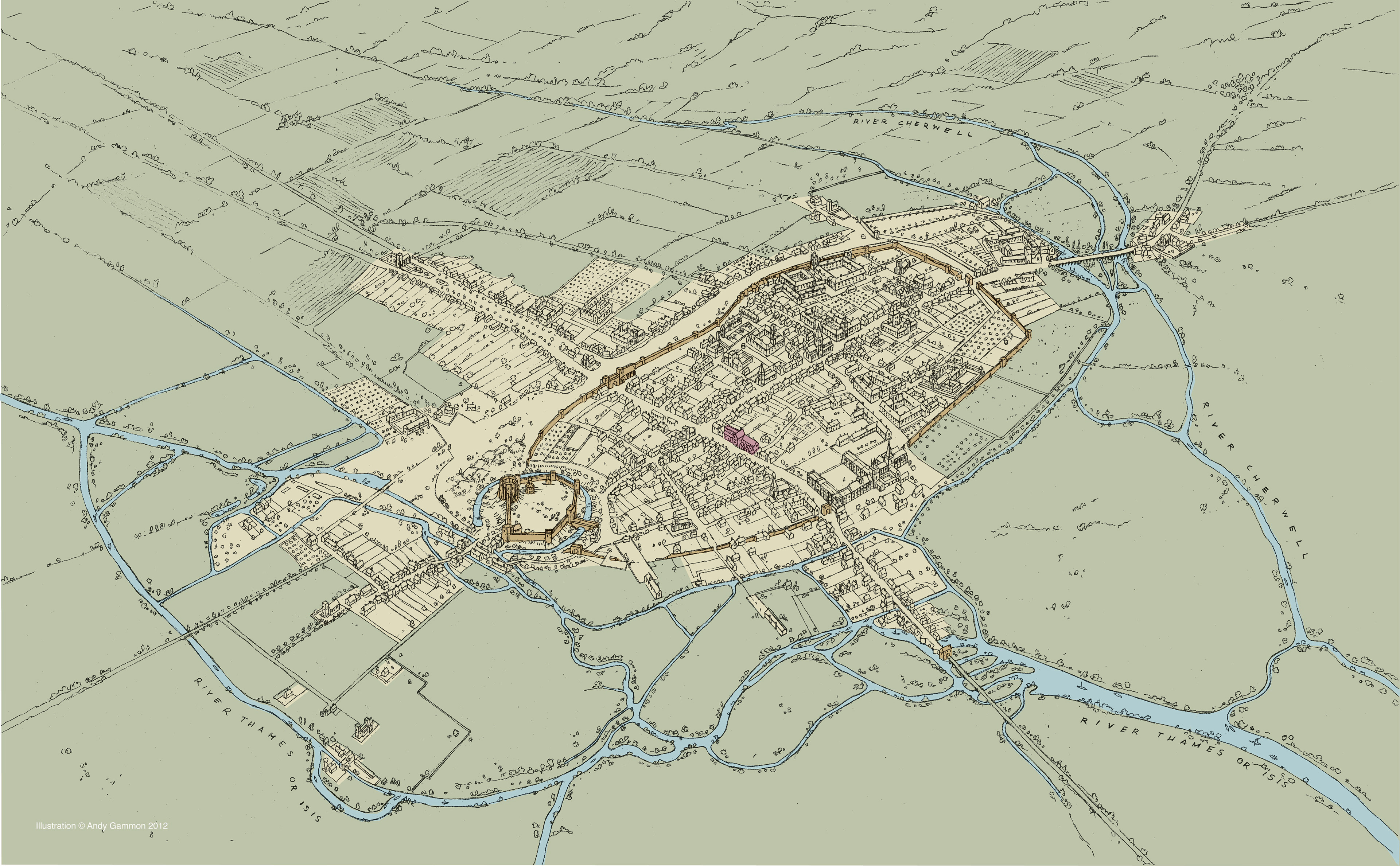
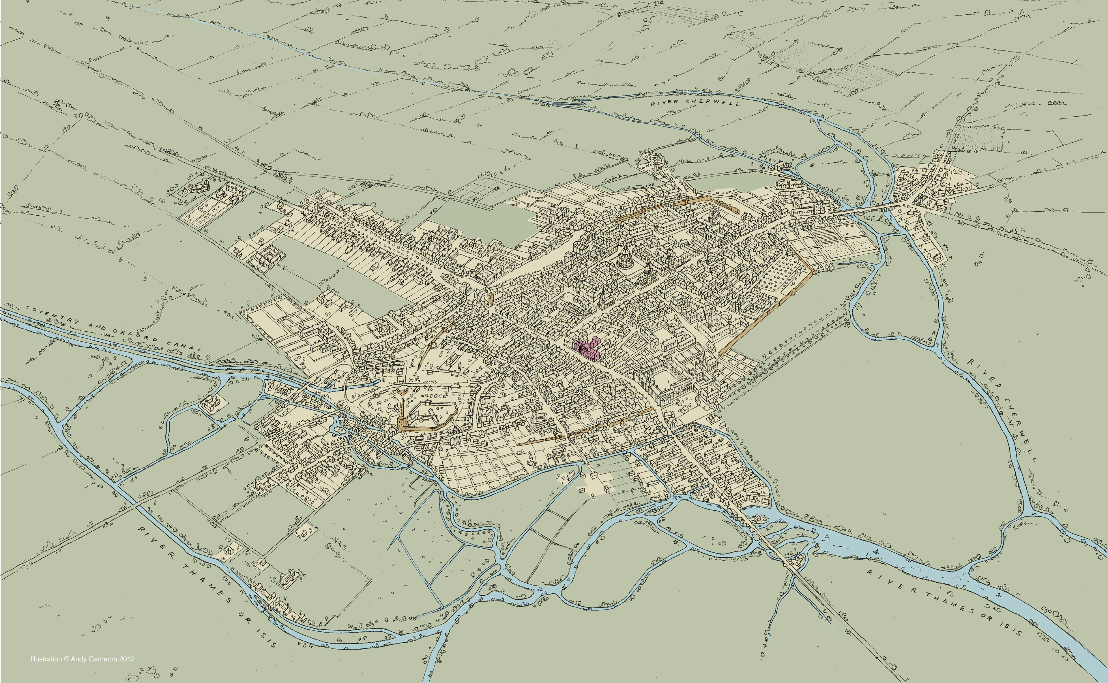
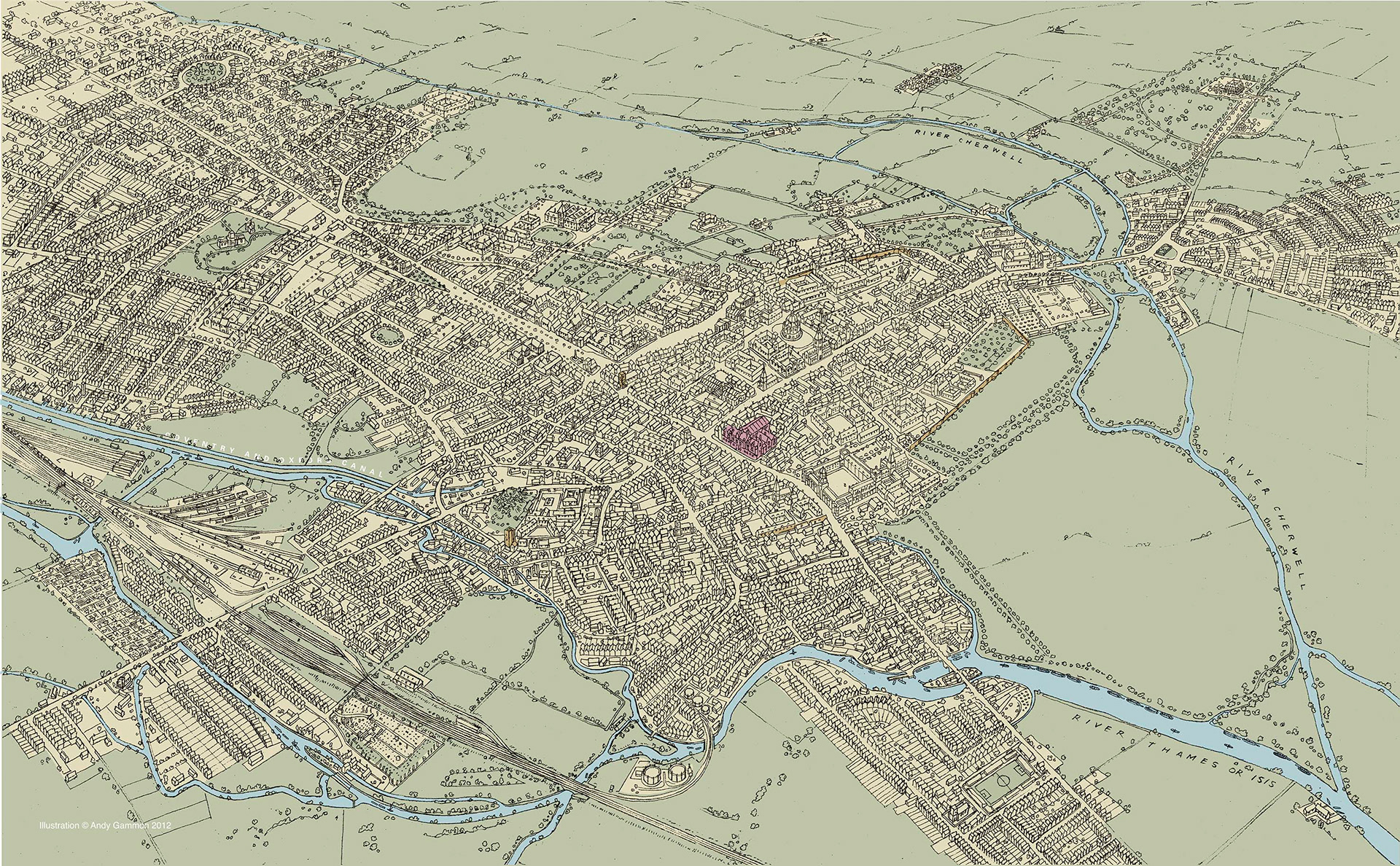
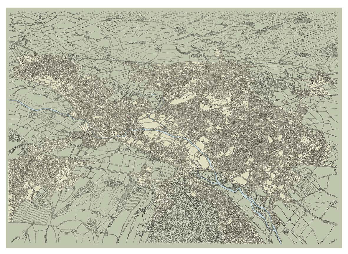
The above, aerial views that indicate the origins of Oxford town in approximately 910 and its subsequent development through 1270, 1578, 1790, 1897 and lastly into the 20thC.
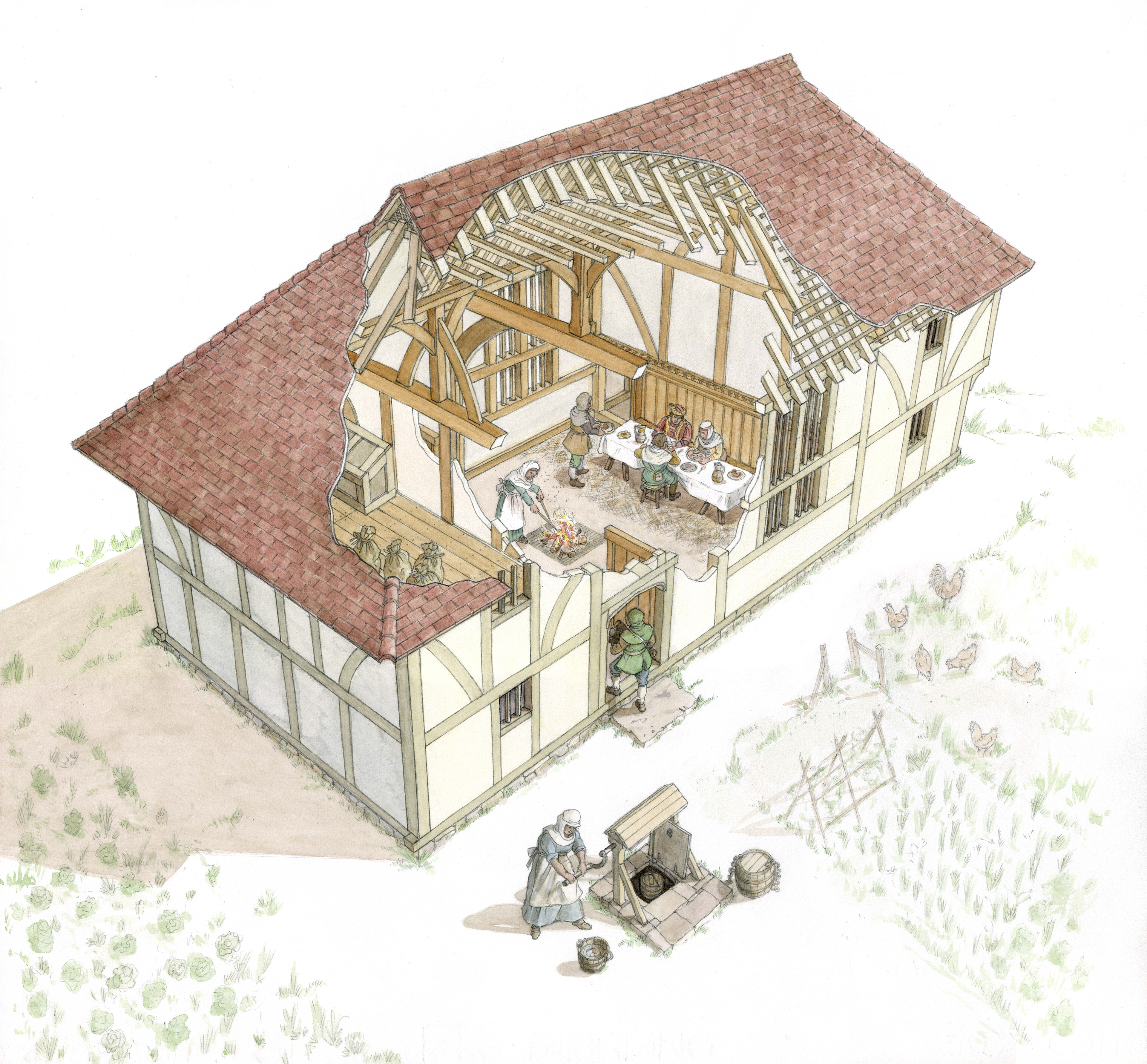
A reconstruction cut-away of Coppards farm house when it was a Wealden hall house in the late 15thC.
Exterior interpretation panels designed for single colour line work for etching into the metal to allow rubbings to be taken. This allows the information to be copied by students for further study.
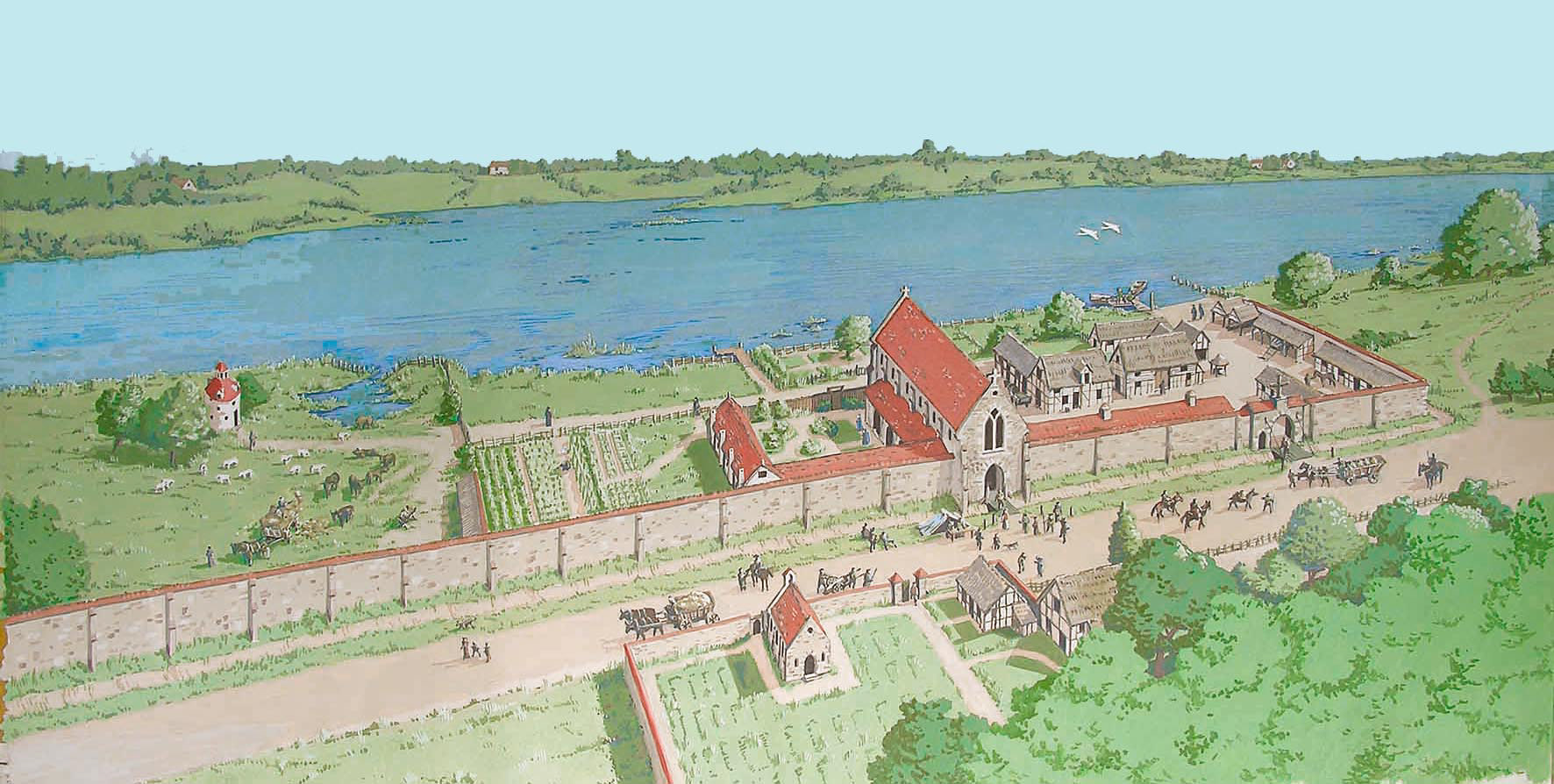
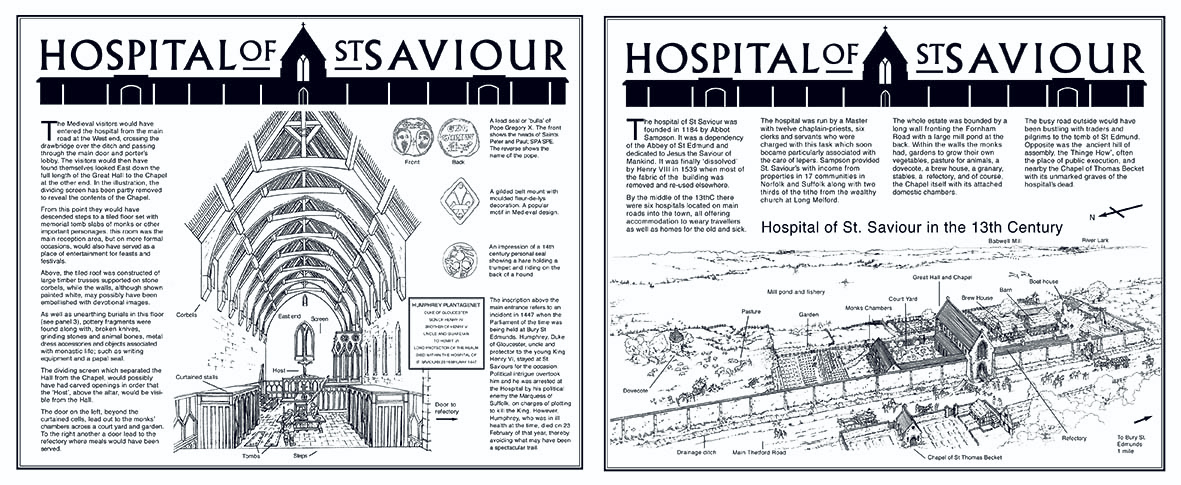
St Saviours Hospital Bury St Edmonds as it was in the 14th century, with its precinct containing stables, dovecote, brewery, boat jetty and gardens. The cemetery and its chapel are on the opposite side of the road.
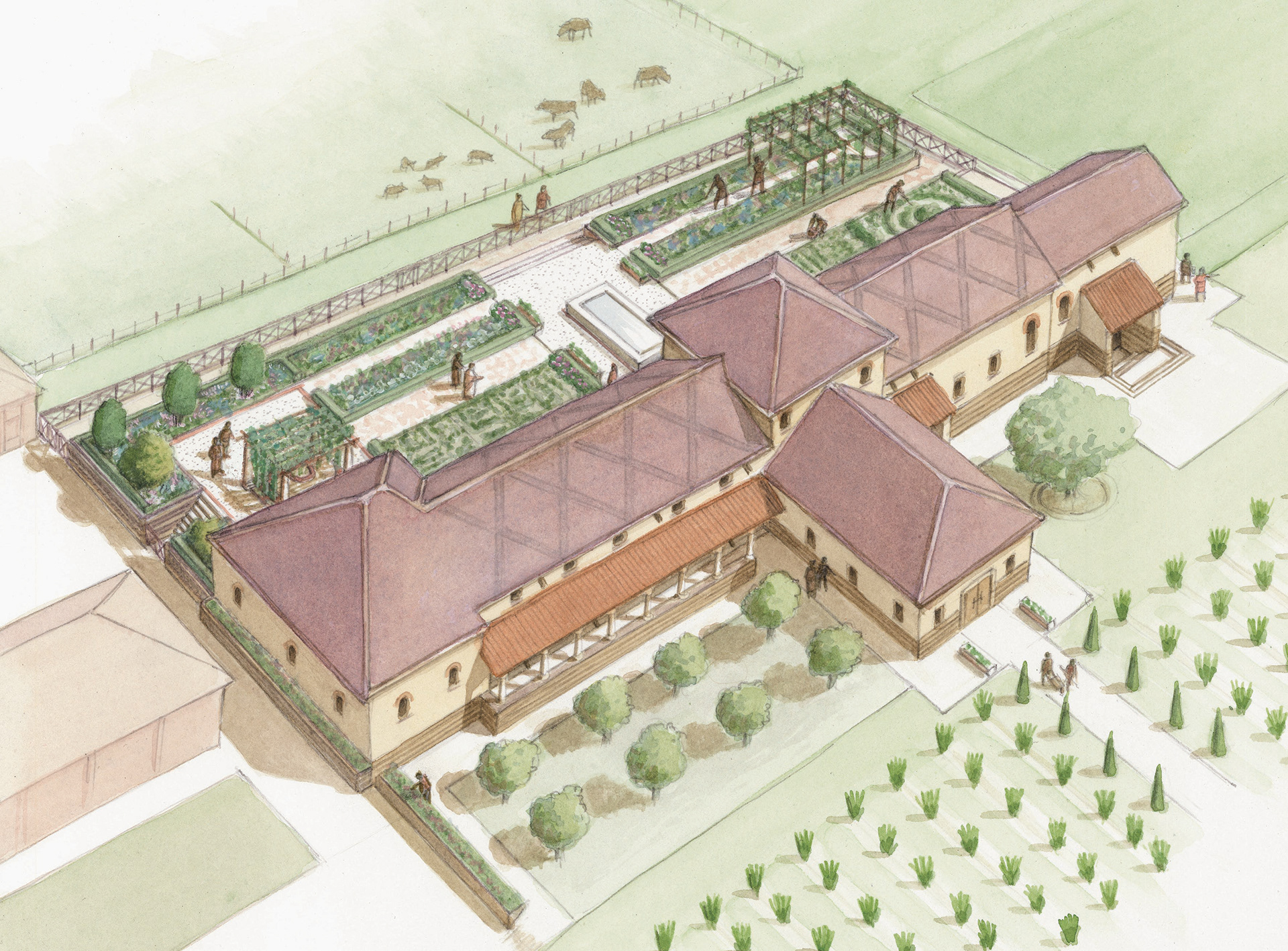
The Villa Venta, Somerset, A modern Roman Villa reconstructed near its original site and opened as a museum.